You are here: Home > Network List > TA - USArray Transportable Network (new EarthScope stations) Stations List
> Station G22A Birney, MT, USA > Earthquake Result Viewer
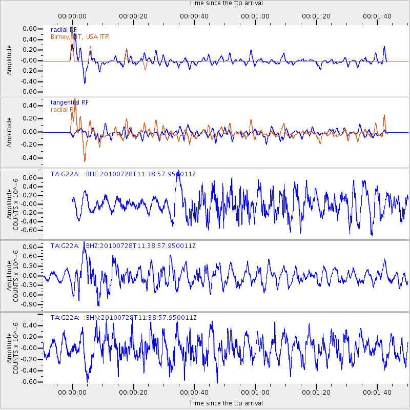
G22A Birney, MT, USA - Earthquake Result Viewer
*The percent match for this event was below the threshold and hence no stack was calculated.
| Earthquake location: |
Fox Islands, Aleutian Islands |
| Earthquake latitude/longitude: |
52.7/-169.4 |
| Earthquake time(UTC): |
2010/07/28 (209) 11:31:46 GMT |
| Earthquake Depth: |
10 km |
| Earthquake Magnitude: |
5.6 MW, 5.2 MS, 5.2 MB, 5.1 ML |
| Earthquake Catalog/Contributor: |
WHDF/NEIC |
|
| Network: |
TA USArray Transportable Network (new EarthScope stations) |
| Station: |
G22A Birney, MT, USA |
| Lat/Lon: |
45.22 N/106.29 W |
| Elevation: |
1203 m |
|
| Distance: |
40.9 deg |
| Az: |
74.287 deg |
| Baz: |
303.954 deg |
| Ray Param: |
$rayparam |
*The percent match for this event was below the threshold and hence was not used in the summary stack. |
|
| Radial Match: |
71.8639 % |
| Radial Bump: |
400 |
| Transverse Match: |
50.091293 % |
| Transverse Bump: |
400 |
| SOD ConfigId: |
319893 |
| Insert Time: |
2011-01-05 13:31:51.066 +0000 |
| GWidth: |
2.5 |
| Max Bumps: |
400 |
| Tol: |
0.001 |
|
Signal To Noise
| Channel | StoN | STA | LTA |
| TA:G22A: :BHZ:20100728T11:38:57.950011Z | 4.432935 | 5.0191846E-7 | 1.13224864E-7 |
| TA:G22A: :BHN:20100728T11:38:57.950011Z | 1.0680622 | 2.006767E-7 | 1.8788859E-7 |
| TA:G22A: :BHE:20100728T11:38:57.950011Z | 2.4605117 | 3.3157895E-7 | 1.3476014E-7 |
| Arrivals |
| Ps | |
| PpPs | |
| PsPs/PpSs | |


