You are here: Home > Network List > TA - USArray Transportable Network (new EarthScope stations) Stations List
> Station Z29A Hungry Hill Ranch, Wilson, TX, USA > Earthquake Result Viewer
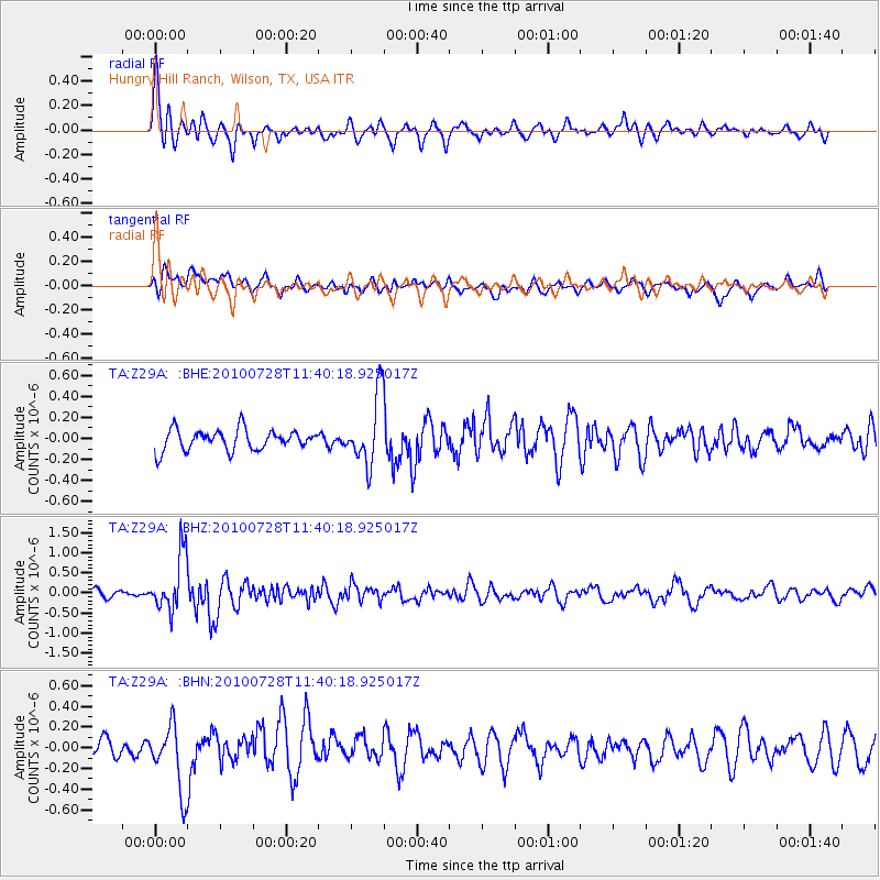
Z29A Hungry Hill Ranch, Wilson, TX, USA - Earthquake Result Viewer
*The percent match for this event was below the threshold and hence no stack was calculated.
| Earthquake location: |
Fox Islands, Aleutian Islands |
| Earthquake latitude/longitude: |
52.7/-169.4 |
| Earthquake time(UTC): |
2010/07/28 (209) 11:31:46 GMT |
| Earthquake Depth: |
10 km |
| Earthquake Magnitude: |
5.6 MW, 5.2 MS, 5.2 MB, 5.1 ML |
| Earthquake Catalog/Contributor: |
WHDF/NEIC |
|
| Network: |
TA USArray Transportable Network (new EarthScope stations) |
| Station: |
Z29A Hungry Hill Ranch, Wilson, TX, USA |
| Lat/Lon: |
33.26 N/101.71 W |
| Elevation: |
938 m |
|
| Distance: |
51.2 deg |
| Az: |
84.087 deg |
| Baz: |
313.698 deg |
| Ray Param: |
$rayparam |
*The percent match for this event was below the threshold and hence was not used in the summary stack. |
|
| Radial Match: |
66.59921 % |
| Radial Bump: |
400 |
| Transverse Match: |
56.738785 % |
| Transverse Bump: |
400 |
| SOD ConfigId: |
319893 |
| Insert Time: |
2011-01-05 13:33:58.484 +0000 |
| GWidth: |
2.5 |
| Max Bumps: |
400 |
| Tol: |
0.001 |
|
Signal To Noise
| Channel | StoN | STA | LTA |
| TA:Z29A: :BHZ:20100728T11:40:18.925017Z | 7.3419967 | 6.862854E-7 | 9.347394E-8 |
| TA:Z29A: :BHN:20100728T11:40:18.925017Z | 4.104987 | 3.1101155E-7 | 7.576431E-8 |
| TA:Z29A: :BHE:20100728T11:40:18.925017Z | 3.3374727 | 3.245663E-7 | 9.724912E-8 |
| Arrivals |
| Ps | |
| PpPs | |
| PsPs/PpSs | |


