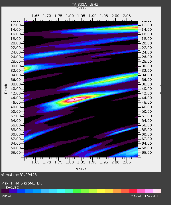
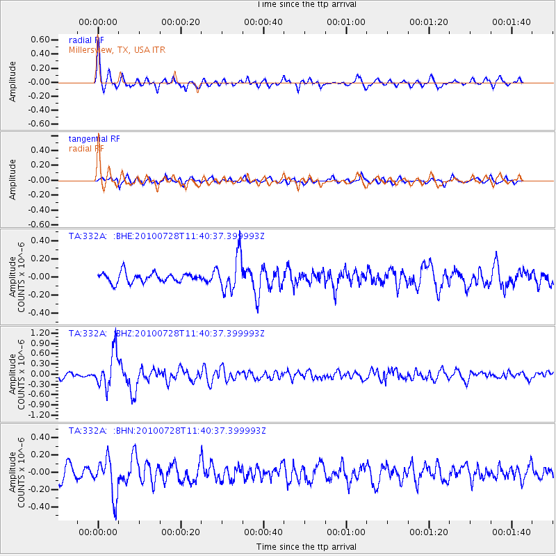
332A Millersview, TX, USA - Earthquake Result Viewer

Earthquake location: Fox Islands, Aleutian Islands
Earthquake latitude/longitude: 52.7/-169.4
Earthquake time(UTC): 2010/07/28 (209) 11:31:46 GMT
Earthquake Depth: 10 km
Earthquake Magnitude: 5.6 MW, 5.2 MS, 5.2 MB, 5.1 ML
Earthquake Catalog/Contributor: WHDF/NEIC
Network: TA USArray Transportable Network (new EarthScope stations)
Station: 332A Millersview, TX, USA
Lat/Lon: 31.38 N/99.74 W
Elevation: 513 m
Distance: 53.7 deg
Az: 84.312 deg
Baz: 314.88 deg
Ray Param: 0.06592458
Estimated Moho Depth: 44.5 km
Estimated Crust Vp/Vs: 1.82
Assumed Crust Vp: 6.498 km/s
Estimated Crust Vs: 3.57 km/s
Estimated Crust Poisson's Ratio: 0.28
Radial Match: 81.99445 %
Radial Bump: 372
Transverse Match: 60.493767 %
Transverse Bump: 400
SOD ConfigId: 319893
Insert Time: 2011-01-05 13:36:09.240 +0000
GWidth: 2.5
Max Bumps: 400
Tol: 0.001

Signal To Noise

ChannelStoNSTALTA
TA:332A: :BHZ:20100728T11:40:37.399993Z9.1676575.242388E-75.718351E-8
TA:332A: :BHN:20100728T11:40:37.399993Z3.3491162.2576565E-76.741052E-8
TA:332A: :BHE:20100728T11:40:37.399993Z3.79097322.0042232E-75.28683E-8
Arrivals
Ps5.9 SECOND
PpPs18 SECOND
PsPs/PpSs24 SECOND