R29A Marienthal, KS, USA - Earthquake Result Viewer
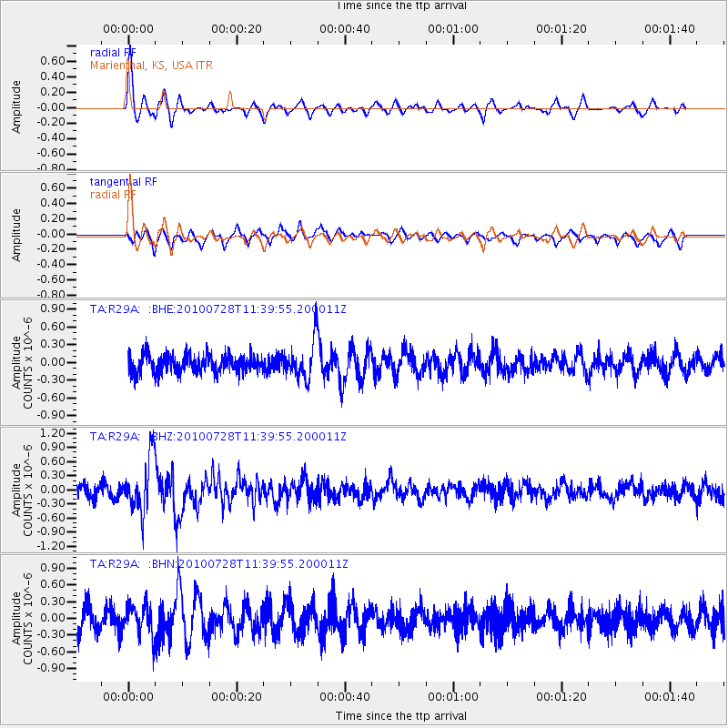
Earthquake location: Fox Islands, Aleutian Islands
Earthquake latitude/longitude: 52.7/-169.4
Earthquake time(UTC): 2010/07/28 (209) 11:31:46 GMT
Earthquake Depth: 10 km
Earthquake Magnitude: 5.6 MW, 5.2 MS, 5.2 MB, 5.1 ML
Earthquake Catalog/Contributor: WHDF/NEIC
Network: TA USArray Transportable Network (new EarthScope stations)
Station: R29A Marienthal, KS, USA
Lat/Lon: 38.42 N/101.14 W
Elevation: 957 m
Distance: 48.1 deg
Az: 78.664 deg
Baz: 310.514 deg
Ray Param: 0.06958209
Estimated Moho Depth: 59.75 km
Estimated Crust Vp/Vs: 1.68
Assumed Crust Vp: 6.483 km/s
Estimated Crust Vs: 3.864 km/s
Estimated Crust Poisson's Ratio: 0.22
Radial Match: 80.30775 %
Radial Bump: 396
Transverse Match: 69.19466 %
Transverse Bump: 400
SOD ConfigId: 319893
Insert Time: 2011-01-05 13:38:51.389 +0000
GWidth: 2.5
Max Bumps: 400
Tol: 0.001

Signal To Noise

ChannelStoNSTALTA
TA:R29A: :BHZ:20100728T11:39:55.200011Z4.63754755.852711E-71.262027E-7
TA:R29A: :BHN:20100728T11:39:55.200011Z1.38490772.808133E-72.027668E-7
TA:R29A: :BHE:20100728T11:39:55.200011Z2.18891623.305289E-71.5100117E-7
Arrivals
Ps6.7 SECOND
PpPs23 SECOND
PsPs/PpSs30 SECOND