You are here: Home > Network List > TA - USArray Transportable Network (new EarthScope stations) Stations List
> Station G29A Hoven, SD, USA > Earthquake Result Viewer
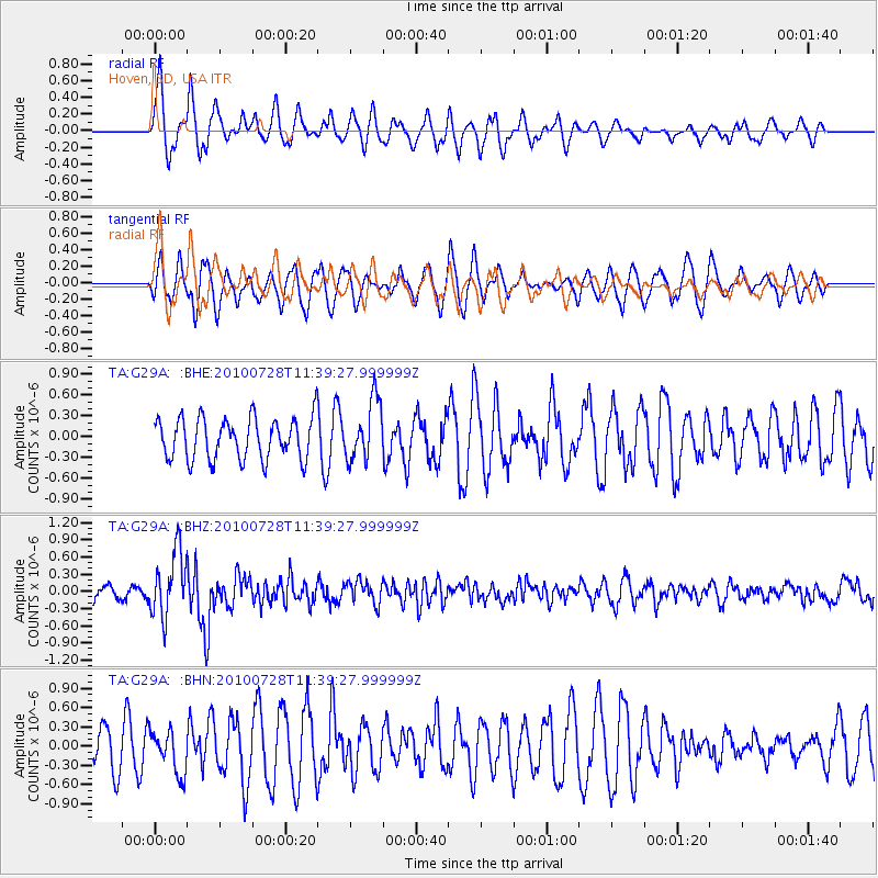
G29A Hoven, SD, USA - Earthquake Result Viewer
*The percent match for this event was below the threshold and hence no stack was calculated.
| Earthquake location: |
Fox Islands, Aleutian Islands |
| Earthquake latitude/longitude: |
52.7/-169.4 |
| Earthquake time(UTC): |
2010/07/28 (209) 11:31:46 GMT |
| Earthquake Depth: |
10 km |
| Earthquake Magnitude: |
5.6 MW, 5.2 MS, 5.2 MB, 5.1 ML |
| Earthquake Catalog/Contributor: |
WHDF/NEIC |
|
| Network: |
TA USArray Transportable Network (new EarthScope stations) |
| Station: |
G29A Hoven, SD, USA |
| Lat/Lon: |
45.19 N/99.92 W |
| Elevation: |
588 m |
|
| Distance: |
44.6 deg |
| Az: |
70.533 deg |
| Baz: |
305.703 deg |
| Ray Param: |
$rayparam |
*The percent match for this event was below the threshold and hence was not used in the summary stack. |
|
| Radial Match: |
61.17605 % |
| Radial Bump: |
400 |
| Transverse Match: |
62.403343 % |
| Transverse Bump: |
391 |
| SOD ConfigId: |
319893 |
| Insert Time: |
2011-01-05 13:45:14.693 +0000 |
| GWidth: |
2.5 |
| Max Bumps: |
400 |
| Tol: |
0.001 |
|
Signal To Noise
| Channel | StoN | STA | LTA |
| TA:G29A: :BHZ:20100728T11:39:27.999999Z | 5.530273 | 5.641988E-7 | 1.0202006E-7 |
| TA:G29A: :BHN:20100728T11:39:27.999999Z | 0.76393044 | 3.3282615E-7 | 4.35676E-7 |
| TA:G29A: :BHE:20100728T11:39:27.999999Z | 1.4602658 | 4.322803E-7 | 2.9602853E-7 |
| Arrivals |
| Ps | |
| PpPs | |
| PsPs/PpSs | |


