
N02D Trinity Center, CA, USA - Earthquake Result Viewer
| ||||||||||||||||||
| ||||||||||||||||||
| ||||||||||||||||||
|
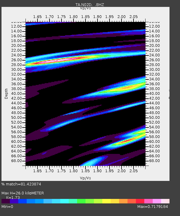
Signal To Noise
| Channel | StoN | STA | LTA |
| TA:N02D: :BHZ:20100728T11:37:54.799987Z | 1.8166943 | 2.5736387E-7 | 1.4166604E-7 |
| TA:N02D: :BHN:20100728T11:37:54.799987Z | 0.6973373 | 7.870337E-8 | 1.1286269E-7 |
| TA:N02D: :BHE:20100728T11:37:54.799987Z | 2.3038208 | 2.5347762E-7 | 1.10024885E-7 |
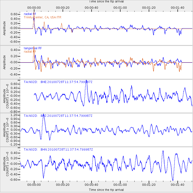
| Arrivals | |
| Ps | 3.1 SECOND |
| PpPs | 9.9 SECOND |
| PsPs/PpSs | 13 SECOND |

