534A Blanco, TX, USA - Earthquake Result Viewer
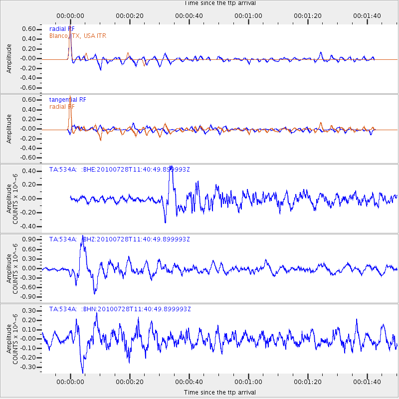
Earthquake location: Fox Islands, Aleutian Islands
Earthquake latitude/longitude: 52.7/-169.4
Earthquake time(UTC): 2010/07/28 (209) 11:31:46 GMT
Earthquake Depth: 10 km
Earthquake Magnitude: 5.6 MW, 5.2 MS, 5.2 MB, 5.1 ML
Earthquake Catalog/Contributor: WHDF/NEIC
Network: TA USArray Transportable Network (new EarthScope stations)
Station: 534A Blanco, TX, USA
Lat/Lon: 30.03 N/98.48 W
Elevation: 461 m
Distance: 55.4 deg
Az: 84.527 deg
Baz: 315.648 deg
Ray Param: 0.06480053
Estimated Moho Depth: 21.25 km
Estimated Crust Vp/Vs: 1.64
Assumed Crust Vp: 6.498 km/s
Estimated Crust Vs: 3.968 km/s
Estimated Crust Poisson's Ratio: 0.20
Radial Match: 86.80712 %
Radial Bump: 400
Transverse Match: 79.0887 %
Transverse Bump: 400
SOD ConfigId: 319893
Insert Time: 2011-01-05 13:48:01.784 +0000
GWidth: 2.5
Max Bumps: 400
Tol: 0.001

Signal To Noise

ChannelStoNSTALTA
TA:534A: :BHZ:20100728T11:40:49.899993Z8.1166194.5482156E-75.6035834E-8
TA:534A: :BHN:20100728T11:40:49.899993Z4.1149291.5601361E-73.7914045E-8
TA:534A: :BHE:20100728T11:40:49.899993Z8.3668852.3495501E-72.8081537E-8
Arrivals
Ps2.2 SECOND
PpPs8.1 SECOND
PsPs/PpSs10 SECOND