You are here: Home > Network List > US - United States National Seismic Network Stations List
> Station HAWA Hanford, Washington, USA > Earthquake Result Viewer
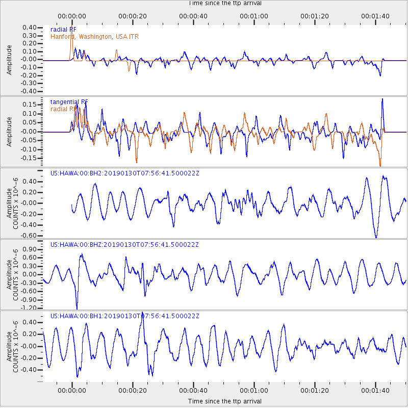
HAWA Hanford, Washington, USA - Earthquake Result Viewer
*The percent match for this event was below the threshold and hence no stack was calculated.
| Earthquake location: |
Near Coast Of Northern Chile |
| Earthquake latitude/longitude: |
-25.9/-70.7 |
| Earthquake time(UTC): |
2019/01/30 (030) 07:44:44 GMT |
| Earthquake Depth: |
39 km |
| Earthquake Magnitude: |
5.6 Mww |
| Earthquake Catalog/Contributor: |
NEIC PDE/us |
|
| Network: |
US United States National Seismic Network |
| Station: |
HAWA Hanford, Washington, USA |
| Lat/Lon: |
46.39 N/119.53 W |
| Elevation: |
364 m |
|
| Distance: |
84.5 deg |
| Az: |
328.452 deg |
| Baz: |
137.101 deg |
| Ray Param: |
$rayparam |
*The percent match for this event was below the threshold and hence was not used in the summary stack. |
|
| Radial Match: |
39.689514 % |
| Radial Bump: |
392 |
| Transverse Match: |
49.955402 % |
| Transverse Bump: |
400 |
| SOD ConfigId: |
3287751 |
| Insert Time: |
2019-02-13 08:03:25.776 +0000 |
| GWidth: |
2.5 |
| Max Bumps: |
400 |
| Tol: |
0.001 |
|
Signal To Noise
| Channel | StoN | STA | LTA |
| US:HAWA:00:BHZ:20190130T07:56:41.500022Z | 2.3411078 | 5.4096733E-7 | 2.3107322E-7 |
| US:HAWA:00:BH1:20190130T07:56:41.500022Z | 2.0654047 | 3.0380474E-7 | 1.4709211E-7 |
| US:HAWA:00:BH2:20190130T07:56:41.500022Z | 0.95090336 | 1.7731676E-7 | 1.8647191E-7 |
| Arrivals |
| Ps | |
| PpPs | |
| PsPs/PpSs | |


