433A Art, TX, USA - Earthquake Result Viewer
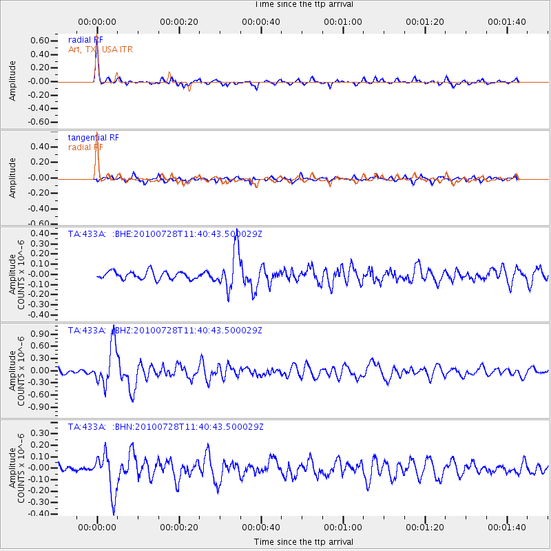
Earthquake location: Fox Islands, Aleutian Islands
Earthquake latitude/longitude: 52.7/-169.4
Earthquake time(UTC): 2010/07/28 (209) 11:31:46 GMT
Earthquake Depth: 10 km
Earthquake Magnitude: 5.6 MW, 5.2 MS, 5.2 MB, 5.1 ML
Earthquake Catalog/Contributor: WHDF/NEIC
Network: TA USArray Transportable Network (new EarthScope stations)
Station: 433A Art, TX, USA
Lat/Lon: 30.75 N/99.09 W
Elevation: 447 m
Distance: 54.5 deg
Az: 84.37 deg
Baz: 315.248 deg
Ray Param: 0.06538561
Estimated Moho Depth: 38.25 km
Estimated Crust Vp/Vs: 1.86
Assumed Crust Vp: 6.498 km/s
Estimated Crust Vs: 3.503 km/s
Estimated Crust Poisson's Ratio: 0.30
Radial Match: 80.71542 %
Radial Bump: 338
Transverse Match: 65.2522 %
Transverse Bump: 400
SOD ConfigId: 319893
Insert Time: 2011-01-05 13:48:35.707 +0000
GWidth: 2.5
Max Bumps: 400
Tol: 0.001

Signal To Noise

ChannelStoNSTALTA
TA:433A: :BHZ:20100728T11:40:43.500029Z7.97352555.070063E-76.3586214E-8
TA:433A: :BHN:20100728T11:40:43.500029Z4.87121.757305E-73.6075406E-8
TA:433A: :BHE:20100728T11:40:43.500029Z5.27185441.9625791E-73.722749E-8
Arrivals
Ps5.3 SECOND
PpPs16 SECOND
PsPs/PpSs21 SECOND