You are here: Home > Network List > TA - USArray Transportable Network (new EarthScope stations) Stations List
> Station 833A Chaparral WMA, Artesia Wells, TX, USA > Earthquake Result Viewer
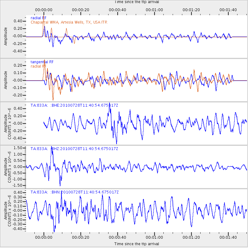
833A Chaparral WMA, Artesia Wells, TX, USA - Earthquake Result Viewer
*The percent match for this event was below the threshold and hence no stack was calculated.
| Earthquake location: |
Fox Islands, Aleutian Islands |
| Earthquake latitude/longitude: |
52.7/-169.4 |
| Earthquake time(UTC): |
2010/07/28 (209) 11:31:46 GMT |
| Earthquake Depth: |
10 km |
| Earthquake Magnitude: |
5.6 MW, 5.2 MS, 5.2 MB, 5.1 ML |
| Earthquake Catalog/Contributor: |
WHDF/NEIC |
|
| Network: |
TA USArray Transportable Network (new EarthScope stations) |
| Station: |
833A Chaparral WMA, Artesia Wells, TX, USA |
| Lat/Lon: |
28.32 N/99.39 W |
| Elevation: |
171 m |
|
| Distance: |
56.1 deg |
| Az: |
86.653 deg |
| Baz: |
316.399 deg |
| Ray Param: |
$rayparam |
*The percent match for this event was below the threshold and hence was not used in the summary stack. |
|
| Radial Match: |
63.92843 % |
| Radial Bump: |
400 |
| Transverse Match: |
53.427505 % |
| Transverse Bump: |
377 |
| SOD ConfigId: |
319893 |
| Insert Time: |
2011-01-05 13:49:48.258 +0000 |
| GWidth: |
2.5 |
| Max Bumps: |
400 |
| Tol: |
0.001 |
|
Signal To Noise
| Channel | StoN | STA | LTA |
| TA:833A: :BHZ:20100728T11:40:54.675017Z | 5.292671 | 7.058007E-7 | 1.3335433E-7 |
| TA:833A: :BHN:20100728T11:40:54.675017Z | 1.0130503 | 1.2394625E-7 | 1.2234955E-7 |
| TA:833A: :BHE:20100728T11:40:54.675017Z | 1.1665114 | 1.275153E-7 | 1.0931338E-7 |
| Arrivals |
| Ps | |
| PpPs | |
| PsPs/PpSs | |


