435B Jarrell, TX, USA - Earthquake Result Viewer
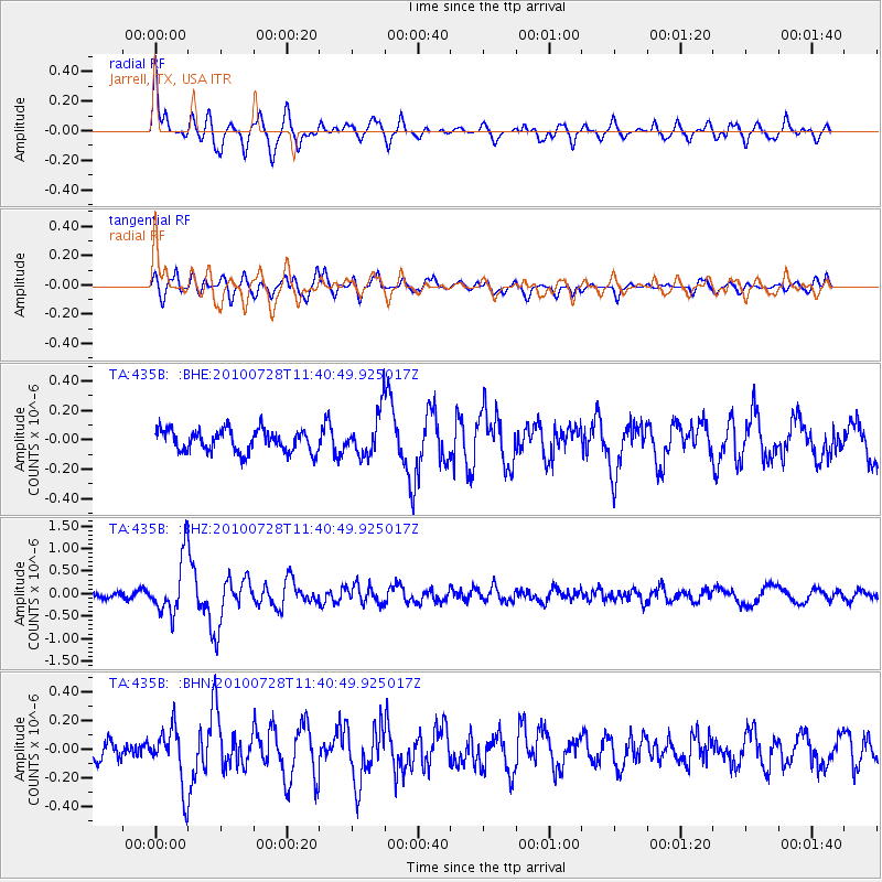
Earthquake location: Fox Islands, Aleutian Islands
Earthquake latitude/longitude: 52.7/-169.4
Earthquake time(UTC): 2010/07/28 (209) 11:31:46 GMT
Earthquake Depth: 10 km
Earthquake Magnitude: 5.6 MW, 5.2 MS, 5.2 MB, 5.1 ML
Earthquake Catalog/Contributor: WHDF/NEIC
Network: TA USArray Transportable Network (new EarthScope stations)
Station: 435B Jarrell, TX, USA
Lat/Lon: 30.78 N/97.58 W
Elevation: 248 m
Distance: 55.4 deg
Az: 83.221 deg
Baz: 315.355 deg
Ray Param: 0.06479867
Estimated Moho Depth: 36.25 km
Estimated Crust Vp/Vs: 1.96
Assumed Crust Vp: 6.347 km/s
Estimated Crust Vs: 3.242 km/s
Estimated Crust Poisson's Ratio: 0.32
Radial Match: 82.06205 %
Radial Bump: 400
Transverse Match: 79.686424 %
Transverse Bump: 400
SOD ConfigId: 319893
Insert Time: 2011-01-05 13:50:28.141 +0000
GWidth: 2.5
Max Bumps: 400
Tol: 0.001

Signal To Noise

ChannelStoNSTALTA
TA:435B: :BHZ:20100728T11:40:49.925017Z8.6338486.2372646E-77.2241995E-8
TA:435B: :BHN:20100728T11:40:49.925017Z3.17148022.0032397E-76.316419E-8
TA:435B: :BHE:20100728T11:40:49.925017Z2.02113681.4841233E-77.343013E-8
Arrivals
Ps5.7 SECOND
PpPs16 SECOND
PsPs/PpSs22 SECOND