336A Riesel, TX, USA - Earthquake Result Viewer
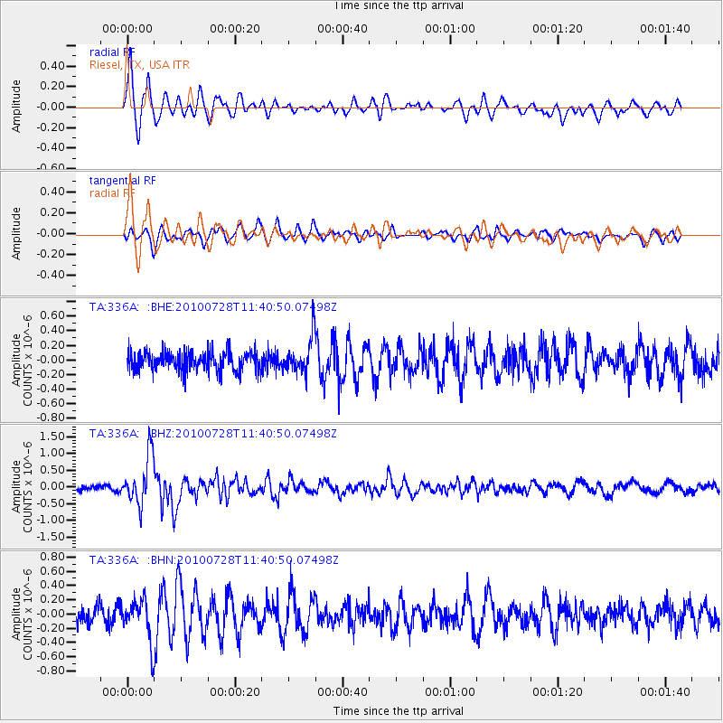
Earthquake location: Fox Islands, Aleutian Islands
Earthquake latitude/longitude: 52.7/-169.4
Earthquake time(UTC): 2010/07/28 (209) 11:31:46 GMT
Earthquake Depth: 10 km
Earthquake Magnitude: 5.6 MW, 5.2 MS, 5.2 MB, 5.1 ML
Earthquake Catalog/Contributor: WHDF/NEIC
Network: TA USArray Transportable Network (new EarthScope stations)
Station: 336A Riesel, TX, USA
Lat/Lon: 31.39 N/96.84 W
Elevation: 140 m
Distance: 55.4 deg
Az: 82.158 deg
Baz: 315.133 deg
Ray Param: 0.06478586
Estimated Moho Depth: 27.0 km
Estimated Crust Vp/Vs: 1.86
Assumed Crust Vp: 6.347 km/s
Estimated Crust Vs: 3.408 km/s
Estimated Crust Poisson's Ratio: 0.30
Radial Match: 84.41356 %
Radial Bump: 400
Transverse Match: 67.06127 %
Transverse Bump: 400
SOD ConfigId: 319893
Insert Time: 2011-01-05 13:50:41.260 +0000
GWidth: 2.5
Max Bumps: 400
Tol: 0.001

Signal To Noise

ChannelStoNSTALTA
TA:336A: :BHZ:20100728T11:40:50.07498Z10.0973117.371802E-77.300757E-8
TA:336A: :BHN:20100728T11:40:50.07498Z2.70954682.908873E-71.0735644E-7
TA:336A: :BHE:20100728T11:40:50.07498Z1.87527172.4670544E-71.3155717E-7
Arrivals
Ps3.8 SECOND
PpPs12 SECOND
PsPs/PpSs15 SECOND