You are here: Home > Network List > US - United States National Seismic Network Stations List
> Station AMTX Amarillo, Texas, USA > Earthquake Result Viewer
AMTX Amarillo, Texas, USA - Earthquake Result Viewer
*The percent match for this event was below the threshold and hence no stack was calculated.
| Earthquake location: |
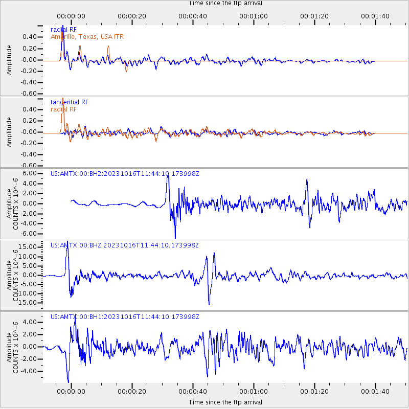
Andreanof Islands, Aleutian Is. |
| Earthquake latitude/longitude: |
52.4/-176.9 |
| Earthquake time(UTC): |
2023/10/16 (289) 11:35:31 GMT |
| Earthquake Depth: |
187 km |
| Earthquake Magnitude: |
6.4 Mww |
| Earthquake Catalog/Contributor: |
NEIC PDE/us |
|
| Network: |
US United States National Seismic Network |
| Station: |
AMTX Amarillo, Texas, USA |
| Lat/Lon: |
34.53 N/101.41 W |
| Elevation: |
1010 m |
|
| Distance: |
55.0 deg |
| Az: |
77.219 deg |
| Baz: |
313.695 deg |
| Ray Param: |
$rayparam |
*The percent match for this event was below the threshold and hence was not used in the summary stack. |
|
| Radial Match: |
91.67873 % |
| Radial Bump: |
400 |
| Transverse Match: |
75.36805 % |
| Transverse Bump: |
400 |
| SOD ConfigId: |
31937991 |
| Insert Time: |
2023-10-30 12:39:46.871 +0000 |
| GWidth: |
2.5 |
| Max Bumps: |
400 |
| Tol: |
0.001 |
|
Signal To Noise
| Channel | StoN | STA | LTA |
| US:AMTX:00:BHZ:20231016T11:44:10.173998Z | 14.303124 | 5.166312E-6 | 3.6120164E-7 |
| US:AMTX:00:BH1:20231016T11:44:10.173998Z | 5.9492183 | 2.4107649E-6 | 4.052238E-7 |
| US:AMTX:00:BH2:20231016T11:44:10.173998Z | 10.450068 | 2.5692234E-6 | 2.4585708E-7 |
| Arrivals |
| Ps | |
| PpPs | |
| PsPs/PpSs | |


