You are here: Home > Network List > AV - Alaska Volcano Observatory Stations List
> Station MAPS Pakushin Southeast, Makushin Volcano, Alaska > Earthquake Result Viewer
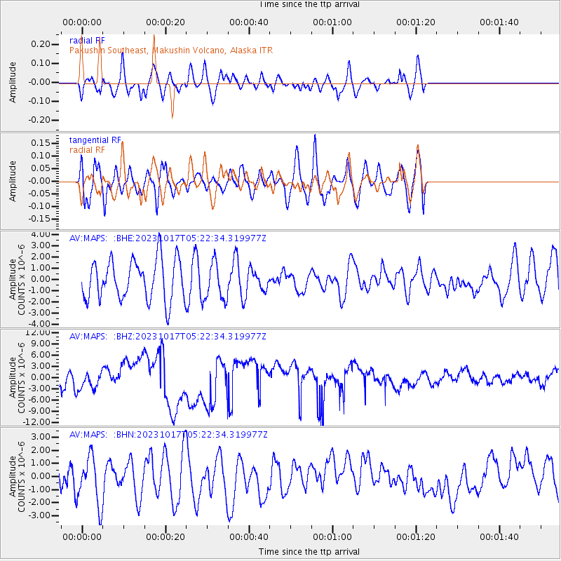
MAPS Pakushin Southeast, Makushin Volcano, Alaska - Earthquake Result Viewer
*The percent match for this event was below the threshold and hence no stack was calculated.
| Earthquake location: |
Southern Iran |
| Earthquake latitude/longitude: |
27.7/56.1 |
| Earthquake time(UTC): |
2023/10/17 (290) 05:10:03 GMT |
| Earthquake Depth: |
10 km |
| Earthquake Magnitude: |
5.5 mww |
| Earthquake Catalog/Contributor: |
NEIC PDE/us |
|
| Network: |
AV Alaska Volcano Observatory |
| Station: |
MAPS Pakushin Southeast, Makushin Volcano, Alaska |
| Lat/Lon: |
53.81 N/166.94 W |
| Elevation: |
333 m |
|
| Distance: |
90.6 deg |
| Az: |
23.897 deg |
| Baz: |
322.741 deg |
| Ray Param: |
$rayparam |
*The percent match for this event was below the threshold and hence was not used in the summary stack. |
|
| Radial Match: |
60.94057 % |
| Radial Bump: |
400 |
| Transverse Match: |
56.873486 % |
| Transverse Bump: |
400 |
| SOD ConfigId: |
31937991 |
| Insert Time: |
2023-10-31 05:16:49.947 +0000 |
| GWidth: |
2.5 |
| Max Bumps: |
400 |
| Tol: |
0.001 |
|
Signal To Noise
| Channel | StoN | STA | LTA |
| AV:MAPS: :BHZ:20231017T05:22:34.319977Z | 1.10901 | 2.7908484E-6 | 2.5165223E-6 |
| AV:MAPS: :BHN:20231017T05:22:34.319977Z | 1.4861585 | 1.9065174E-6 | 1.2828493E-6 |
| AV:MAPS: :BHE:20231017T05:22:34.319977Z | 0.9435803 | 1.6807786E-6 | 1.7812777E-6 |
| Arrivals |
| Ps | |
| PpPs | |
| PsPs/PpSs | |


