You are here: Home > Network List > US - United States National Seismic Network Stations List
> Station MSO Missoula, Montana, USA > Earthquake Result Viewer
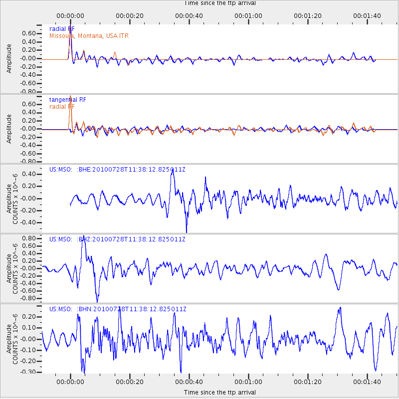
MSO Missoula, Montana, USA - Earthquake Result Viewer
*The percent match for this event was below the threshold and hence no stack was calculated.
| Earthquake location: |
Fox Islands, Aleutian Islands |
| Earthquake latitude/longitude: |
52.7/-169.4 |
| Earthquake time(UTC): |
2010/07/28 (209) 11:31:46 GMT |
| Earthquake Depth: |
10 km |
| Earthquake Magnitude: |
5.6 MW, 5.2 MS, 5.2 MB, 5.1 ML |
| Earthquake Catalog/Contributor: |
WHDF/NEIC |
|
| Network: |
US United States National Seismic Network |
| Station: |
MSO Missoula, Montana, USA |
| Lat/Lon: |
46.83 N/113.94 W |
| Elevation: |
1264 m |
|
| Distance: |
35.5 deg |
| Az: |
76.667 deg |
| Baz: |
300.336 deg |
| Ray Param: |
$rayparam |
*The percent match for this event was below the threshold and hence was not used in the summary stack. |
|
| Radial Match: |
76.52687 % |
| Radial Bump: |
400 |
| Transverse Match: |
58.158268 % |
| Transverse Bump: |
400 |
| SOD ConfigId: |
319893 |
| Insert Time: |
2011-01-05 13:59:22.160 +0000 |
| GWidth: |
2.5 |
| Max Bumps: |
400 |
| Tol: |
0.001 |
|
Signal To Noise
| Channel | StoN | STA | LTA |
| US:MSO: :BHZ:20100728T11:38:12.825011Z | 8.368833 | 3.9940406E-7 | 4.7725184E-8 |
| US:MSO: :BHN:20100728T11:38:12.825011Z | 2.5736828 | 1.4480176E-7 | 5.6262476E-8 |
| US:MSO: :BHE:20100728T11:38:12.825011Z | 3.5327559 | 2.2294611E-7 | 6.3108274E-8 |
| Arrivals |
| Ps | |
| PpPs | |
| PsPs/PpSs | |


