You are here: Home > Network List > CI - Caltech Regional Seismic Network Stations List
> Station MPP McPhearson Peak > Earthquake Result Viewer
MPP McPhearson Peak - Earthquake Result Viewer
*The percent match for this event was below the threshold and hence no stack was calculated.
| Earthquake location: |
Southeast Of Loyalty Islands |
| Earthquake latitude/longitude: |
-22.2/170.7 |
| Earthquake time(UTC): |
2023/10/17 (290) 13:40:32 GMT |
| Earthquake Depth: |
16 km |
| Earthquake Magnitude: |
5.6 Mww |
| Earthquake Catalog/Contributor: |
NEIC PDE/us |
|
| Network: |
CI Caltech Regional Seismic Network |
| Station: |
MPP McPhearson Peak |
| Lat/Lon: |
34.89 N/119.81 W |
| Elevation: |
1739 m |
|
| Distance: |
87.0 deg |
| Az: |
50.441 deg |
| Baz: |
240.346 deg |
| Ray Param: |
$rayparam |
*The percent match for this event was below the threshold and hence was not used in the summary stack. |
|
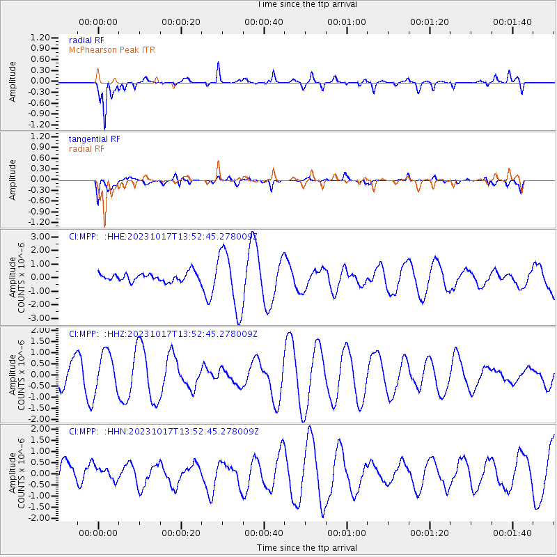
| Radial Match: |
79.69699 % |
| Radial Bump: |
400 |
| Transverse Match: |
58.779987 % |
| Transverse Bump: |
400 |
| SOD ConfigId: |
31937991 |
| Insert Time: |
2023-10-31 13:48:34.206 +0000 |
| GWidth: |
2.5 |
| Max Bumps: |
400 |
| Tol: |
0.001 |
|
Signal To Noise
| Channel | StoN | STA | LTA |
| CI:MPP: :HHZ:20231017T13:52:45.278009Z | 1.8490418 | 8.7168553E-7 | 4.7142555E-7 |
| CI:MPP: :HHN:20231017T13:52:45.278009Z | 0.41063356 | 2.9161419E-7 | 7.1015666E-7 |
| CI:MPP: :HHE:20231017T13:52:45.278009Z | 7.510191 | 2.2533575E-6 | 3.0003994E-7 |
| Arrivals |
| Ps | |
| PpPs | |
| PsPs/PpSs | |


