You are here: Home > Network List > US - United States National Seismic Network Stations List
> Station HAWA Hanford, Washington, USA > Earthquake Result Viewer
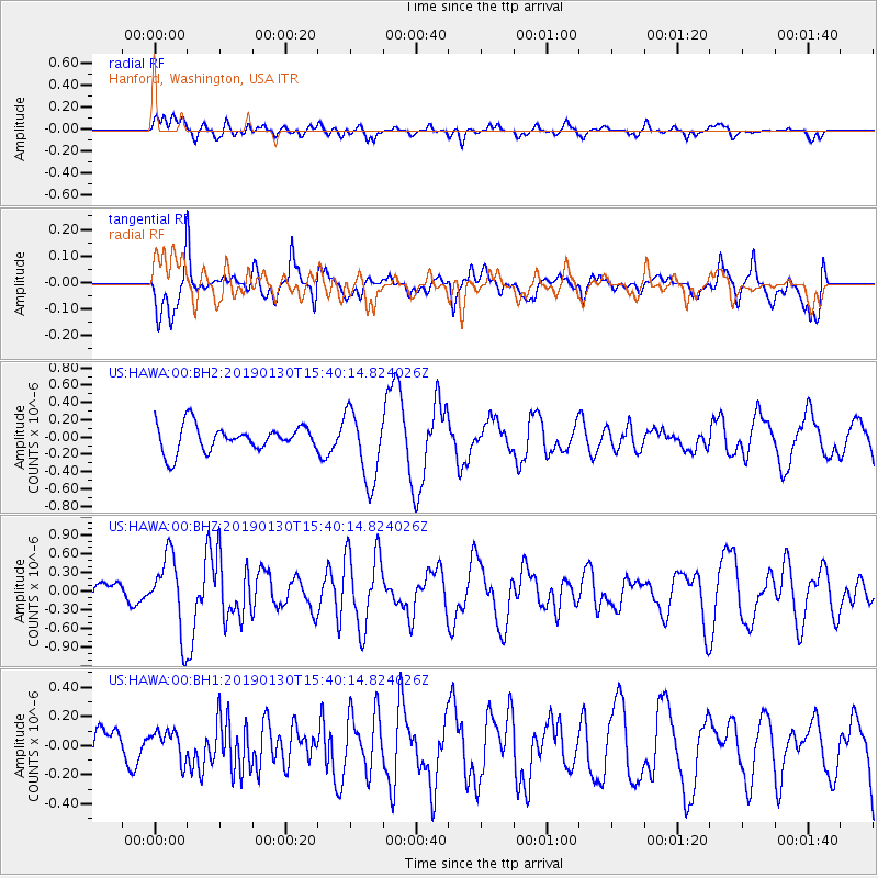
HAWA Hanford, Washington, USA - Earthquake Result Viewer
*The percent match for this event was below the threshold and hence no stack was calculated.
| Earthquake location: |
Central East Pacific Rise |
| Earthquake latitude/longitude: |
-4.6/-105.4 |
| Earthquake time(UTC): |
2019/01/30 (030) 15:31:34 GMT |
| Earthquake Depth: |
10 km |
| Earthquake Magnitude: |
5.9 Mww |
| Earthquake Catalog/Contributor: |
NEIC PDE/us |
|
| Network: |
US United States National Seismic Network |
| Station: |
HAWA Hanford, Washington, USA |
| Lat/Lon: |
46.39 N/119.53 W |
| Elevation: |
364 m |
|
| Distance: |
52.3 deg |
| Az: |
347.704 deg |
| Baz: |
162.139 deg |
| Ray Param: |
$rayparam |
*The percent match for this event was below the threshold and hence was not used in the summary stack. |
|
| Radial Match: |
50.43137 % |
| Radial Bump: |
400 |
| Transverse Match: |
78.504456 % |
| Transverse Bump: |
400 |
| SOD ConfigId: |
3287751 |
| Insert Time: |
2019-02-13 15:41:01.000 +0000 |
| GWidth: |
2.5 |
| Max Bumps: |
400 |
| Tol: |
0.001 |
|
Signal To Noise
| Channel | StoN | STA | LTA |
| US:HAWA:00:BHZ:20190130T15:40:14.824026Z | 2.2946894 | 6.0304114E-7 | 2.6279858E-7 |
| US:HAWA:00:BH1:20190130T15:40:14.824026Z | 0.5611248 | 1.0369254E-7 | 1.8479409E-7 |
| US:HAWA:00:BH2:20190130T15:40:14.824026Z | 2.7223265 | 4.090875E-7 | 1.5027129E-7 |
| Arrivals |
| Ps | |
| PpPs | |
| PsPs/PpSs | |


