You are here: Home > Network List > CN - Canadian National Seismograph Network Stations List
> Station FRB Iqaluit, Nunavut Territory, Canada > Earthquake Result Viewer
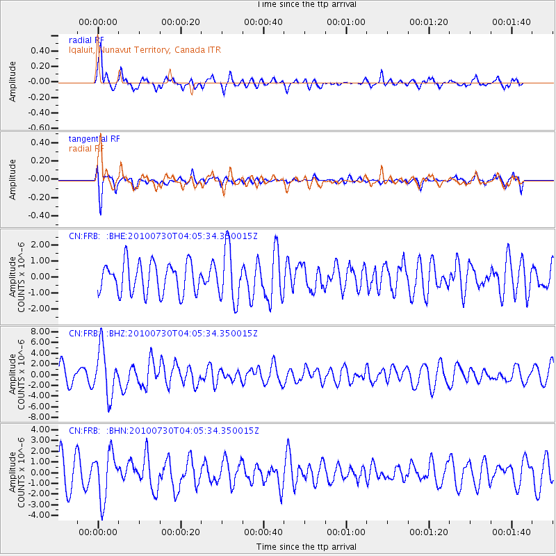
FRB Iqaluit, Nunavut Territory, Canada - Earthquake Result Viewer
*The percent match for this event was below the threshold and hence no stack was calculated.
| Earthquake location: |
Off East Coast Of Kamchatka |
| Earthquake latitude/longitude: |
52.5/159.8 |
| Earthquake time(UTC): |
2010/07/30 (211) 03:56:13 GMT |
| Earthquake Depth: |
23 km |
| Earthquake Magnitude: |
6.1 MB, 6.3 MS, 6.3 MW, 6.3 MW |
| Earthquake Catalog/Contributor: |
WHDF/NEIC |
|
| Network: |
CN Canadian National Seismograph Network |
| Station: |
FRB Iqaluit, Nunavut Territory, Canada |
| Lat/Lon: |
63.75 N/68.55 W |
| Elevation: |
25 m |
|
| Distance: |
58.1 deg |
| Az: |
23.054 deg |
| Baz: |
327.43 deg |
| Ray Param: |
$rayparam |
*The percent match for this event was below the threshold and hence was not used in the summary stack. |
|
| Radial Match: |
74.75687 % |
| Radial Bump: |
400 |
| Transverse Match: |
71.25111 % |
| Transverse Bump: |
400 |
| SOD ConfigId: |
319893 |
| Insert Time: |
2011-01-05 14:18:57.672 +0000 |
| GWidth: |
2.5 |
| Max Bumps: |
400 |
| Tol: |
0.001 |
|
Signal To Noise
| Channel | StoN | STA | LTA |
| CN:FRB: :BHZ:20100730T04:05:34.350015Z | 2.990454 | 4.4794106E-6 | 1.4979032E-6 |
| CN:FRB: :BHN:20100730T04:05:34.350015Z | 1.9798784 | 2.2066365E-6 | 1.1145313E-6 |
| CN:FRB: :BHE:20100730T04:05:34.350015Z | 1.790114 | 1.6912165E-6 | 9.4475354E-7 |
| Arrivals |
| Ps | |
| PpPs | |
| PsPs/PpSs | |


