KIP Kipapa - Hawaii, USA - Earthquake Result Viewer
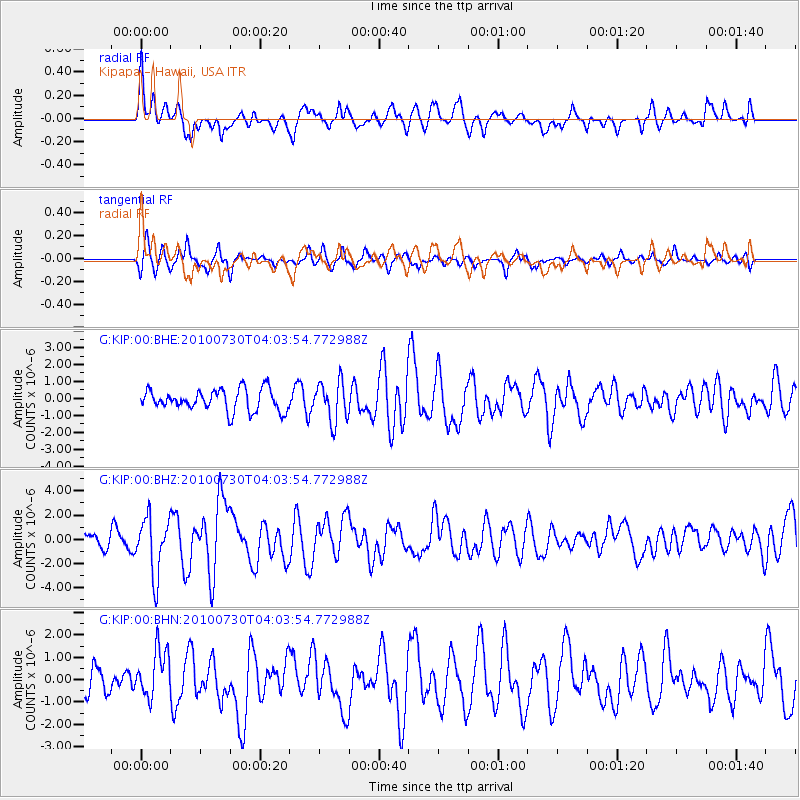
Earthquake location: Off East Coast Of Kamchatka
Earthquake latitude/longitude: 52.5/159.8
Earthquake time(UTC): 2010/07/30 (211) 03:56:13 GMT
Earthquake Depth: 23 km
Earthquake Magnitude: 6.1 MB, 6.3 MS, 6.3 MW, 6.3 MW
Earthquake Catalog/Contributor: WHDF/NEIC
Network: G GEOSCOPE
Station: KIP Kipapa - Hawaii, USA
Lat/Lon: 21.42 N/158.01 W
Elevation: 70 m
Distance: 44.8 deg
Az: 117.447 deg
Baz: 324.388 deg
Ray Param: 0.071667805
Estimated Moho Depth: 10.0 km
Estimated Crust Vp/Vs: 1.84
Assumed Crust Vp: 4.24 km/s
Estimated Crust Vs: 2.304 km/s
Estimated Crust Poisson's Ratio: 0.29
Radial Match: 81.91176 %
Radial Bump: 400
Transverse Match: 74.528946 %
Transverse Bump: 365
SOD ConfigId: 319893
Insert Time: 2011-01-05 14:20:17.875 +0000
GWidth: 2.5
Max Bumps: 400
Tol: 0.001

Signal To Noise

ChannelStoNSTALTA
G:KIP:00:BHZ:20100730T04:03:54.772988Z3.48620082.383621E-66.837302E-7
G:KIP:00:BHN:20100730T04:03:54.772988Z2.28591081.0669115E-64.6673367E-7
G:KIP:00:BHE:20100730T04:03:54.772988Z1.86679321.1826338E-66.335109E-7
Arrivals
Ps2.0 SECOND
PpPs6.5 SECOND
PsPs/PpSs8.6 SECOND