CLF Chambon la Foret observatory, France - Earthquake Result Viewer
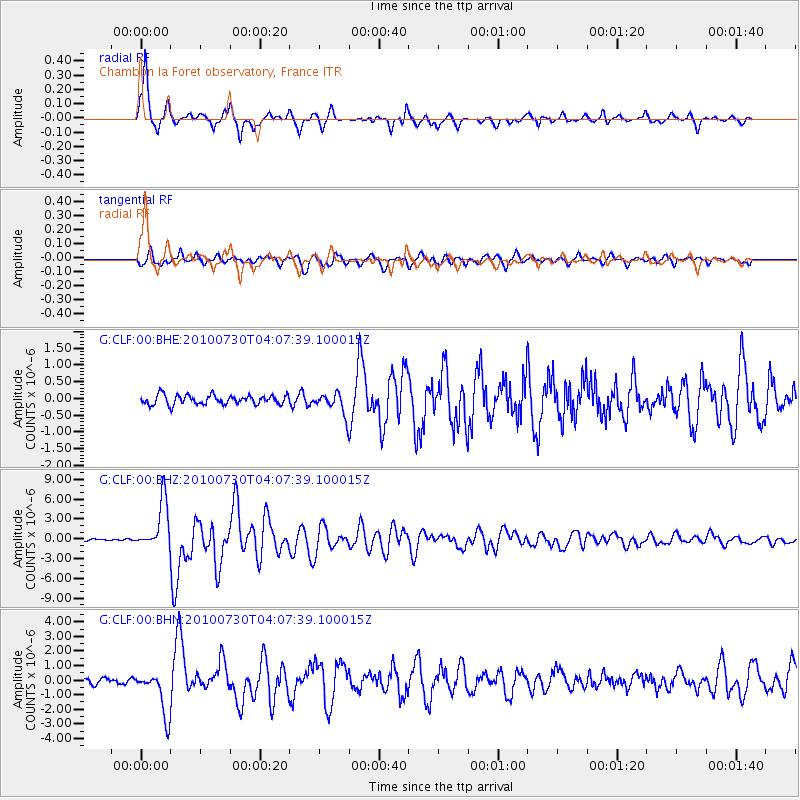
Earthquake location: Off East Coast Of Kamchatka
Earthquake latitude/longitude: 52.5/159.8
Earthquake time(UTC): 2010/07/30 (211) 03:56:13 GMT
Earthquake Depth: 23 km
Earthquake Magnitude: 6.1 MB, 6.3 MS, 6.3 MW, 6.3 MW
Earthquake Catalog/Contributor: WHDF/NEIC
Network: G GEOSCOPE
Station: CLF Chambon la Foret observatory, France
Lat/Lon: 48.03 N/2.26 E
Elevation: 145 m
Distance: 78.0 deg
Az: 344.831 deg
Baz: 13.787 deg
Ray Param: 0.049885523
Estimated Moho Depth: 34.0 km
Estimated Crust Vp/Vs: 1.80
Assumed Crust Vp: 6.12 km/s
Estimated Crust Vs: 3.405 km/s
Estimated Crust Poisson's Ratio: 0.28
Radial Match: 96.35078 %
Radial Bump: 342
Transverse Match: 89.22267 %
Transverse Bump: 400
SOD ConfigId: 319893
Insert Time: 2011-01-05 14:20:18.936 +0000
GWidth: 2.5
Max Bumps: 400
Tol: 0.001

Signal To Noise

ChannelStoNSTALTA
G:CLF:00:BHZ:20100730T04:07:39.100015Z25.8477213.6549873E-61.4140463E-7
G:CLF:00:BHN:20100730T04:07:39.100015Z9.74741.5266862E-61.5662496E-7
G:CLF:00:BHE:20100730T04:07:39.100015Z2.33553123.2575252E-71.3947685E-7
Arrivals
Ps4.6 SECOND
PpPs15 SECOND
PsPs/PpSs20 SECOND