
BRNJ Basking Ridge, New Jersey - Earthquake Result Viewer
| ||||||||||||||||||
| ||||||||||||||||||
| ||||||||||||||||||
|
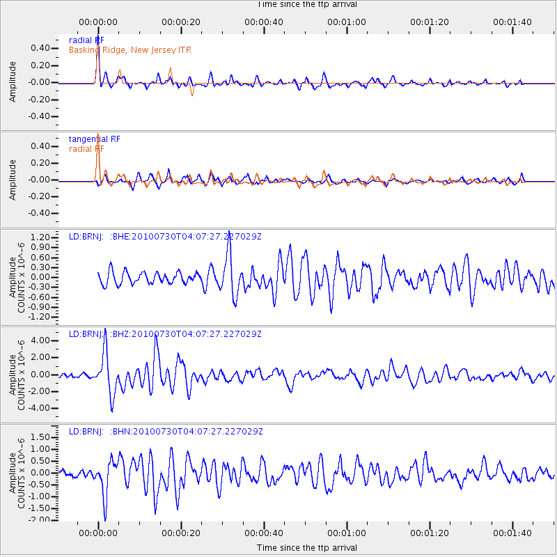
Signal To Noise
| Channel | StoN | STA | LTA |
| LD:BRNJ: :BHZ:20100730T04:07:27.227029Z | 8.877064 | 2.4868557E-6 | 2.8014395E-7 |
| LD:BRNJ: :BHN:20100730T04:07:27.227029Z | 5.147655 | 7.512177E-7 | 1.4593398E-7 |
| LD:BRNJ: :BHE:20100730T04:07:27.227029Z | 3.6445675 | 6.1751336E-7 | 1.6943393E-7 |
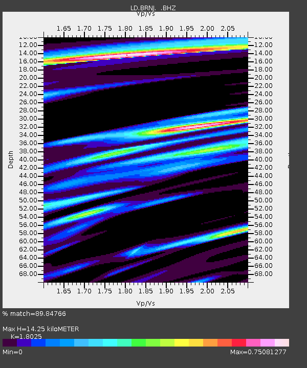
| Arrivals | |
| Ps | 1.9 SECOND |
| PpPs | 6.2 SECOND |
| PsPs/PpSs | 8.0 SECOND |

