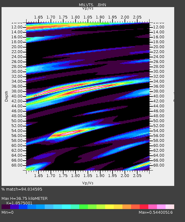
VTS Vitosha, Bulgary - Earthquake Result Viewer
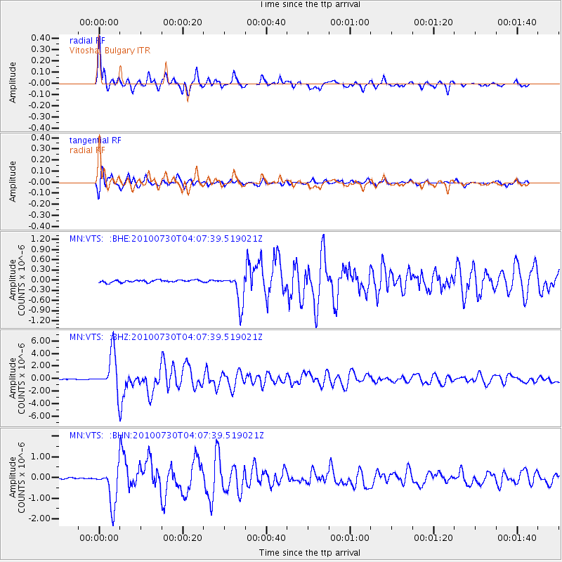
Earthquake location: Off East Coast Of Kamchatka
Earthquake latitude/longitude: 52.5/159.8
Earthquake time(UTC): 2010/07/30 (211) 03:56:13 GMT
Earthquake Depth: 23 km
Earthquake Magnitude: 6.1 MB, 6.3 MS, 6.3 MW, 6.3 MW
Earthquake Catalog/Contributor: WHDF/NEIC
Network: MN MEDNET Project
Station: VTS Vitosha, Bulgary
Lat/Lon: 42.62 N/23.24 E
Elevation: 1490 m
Distance: 78.1 deg
Az: 328.788 deg
Baz: 25.417 deg
Ray Param: 0.049836703
Estimated Moho Depth: 36.75 km
Estimated Crust Vp/Vs: 1.86
Assumed Crust Vp: 6.291 km/s
Estimated Crust Vs: 3.387 km/s
Estimated Crust Poisson's Ratio: 0.30
Radial Match: 94.834595 %
Radial Bump: 342
Transverse Match: 91.38241 %
Transverse Bump: 400
SOD ConfigId: 319893
Insert Time: 2011-01-05 14:25:13.662 +0000
GWidth: 2.5
Max Bumps: 400
Tol: 0.001

Signal To Noise

ChannelStoNSTALTA
MN:VTS: :BHZ:20100730T04:07:39.519021Z72.395813.2296198E-64.4610587E-8
MN:VTS: :BHN:20100730T04:07:39.519021Z41.45899.312255E-72.2461414E-8
MN:VTS: :BHE:20100730T04:07:39.519021Z14.1959424.733068E-73.3340996E-8
Arrivals
Ps5.1 SECOND
PpPs16 SECOND
PsPs/PpSs21 SECOND