You are here: Home > Network List > IW - Intermountain West Stations List
> Station MOOW Moose Ponds, Wyoming, USA > Earthquake Result Viewer
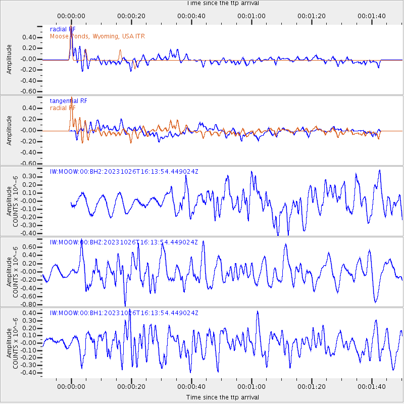
MOOW Moose Ponds, Wyoming, USA - Earthquake Result Viewer
*The percent match for this event was below the threshold and hence no stack was calculated.
| Earthquake location: |
Komandorskiye Ostrova Region |
| Earthquake latitude/longitude: |
56.1/164.7 |
| Earthquake time(UTC): |
2023/10/26 (299) 16:05:11 GMT |
| Earthquake Depth: |
2.4 km |
| Earthquake Magnitude: |
5.9 Mww |
| Earthquake Catalog/Contributor: |
NEIC PDE/us |
|
| Network: |
IW Intermountain West |
| Station: |
MOOW Moose Ponds, Wyoming, USA |
| Lat/Lon: |
43.75 N/110.74 W |
| Elevation: |
2128 m |
|
| Distance: |
52.5 deg |
| Az: |
65.474 deg |
| Baz: |
315.231 deg |
| Ray Param: |
$rayparam |
*The percent match for this event was below the threshold and hence was not used in the summary stack. |
|
| Radial Match: |
76.72873 % |
| Radial Bump: |
400 |
| Transverse Match: |
57.303898 % |
| Transverse Bump: |
400 |
| SOD ConfigId: |
31937991 |
| Insert Time: |
2023-11-09 16:20:53.781 +0000 |
| GWidth: |
2.5 |
| Max Bumps: |
400 |
| Tol: |
0.001 |
|
Signal To Noise
| Channel | StoN | STA | LTA |
| IW:MOOW:00:BHZ:20231026T16:13:54.449024Z | 2.423569 | 2.8531286E-7 | 1.17724255E-7 |
| IW:MOOW:00:BH1:20231026T16:13:54.449024Z | 1.1820554 | 1.2820068E-7 | 1.0845573E-7 |
| IW:MOOW:00:BH2:20231026T16:13:54.449024Z | 1.282406 | 1.05844364E-7 | 8.253577E-8 |
| Arrivals |
| Ps | |
| PpPs | |
| PsPs/PpSs | |


