You are here: Home > Network List > US - United States National Seismic Network Stations List
> Station MSO Missoula, Montana, USA > Earthquake Result Viewer
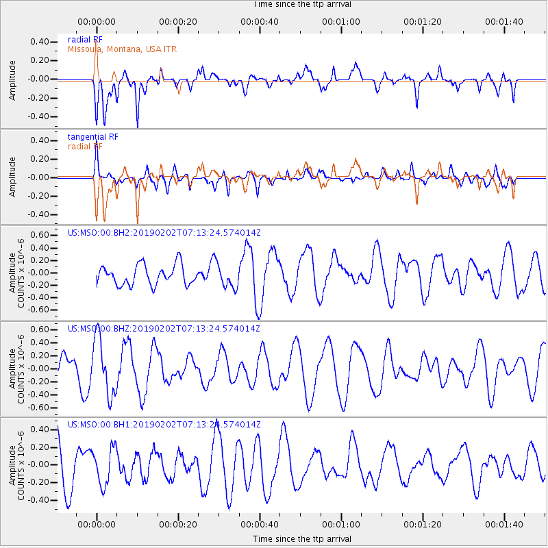
MSO Missoula, Montana, USA - Earthquake Result Viewer
*The percent match for this event was below the threshold and hence no stack was calculated.
| Earthquake location: |
Tonga Islands |
| Earthquake latitude/longitude: |
-15.7/-174.9 |
| Earthquake time(UTC): |
2019/02/02 (033) 07:02:00 GMT |
| Earthquake Depth: |
260 km |
| Earthquake Magnitude: |
5.4 mww |
| Earthquake Catalog/Contributor: |
NEIC PDE/us |
|
| Network: |
US United States National Seismic Network |
| Station: |
MSO Missoula, Montana, USA |
| Lat/Lon: |
46.83 N/113.94 W |
| Elevation: |
1264 m |
|
| Distance: |
82.7 deg |
| Az: |
37.226 deg |
| Baz: |
238.078 deg |
| Ray Param: |
$rayparam |
*The percent match for this event was below the threshold and hence was not used in the summary stack. |
|
| Radial Match: |
63.75785 % |
| Radial Bump: |
394 |
| Transverse Match: |
42.615982 % |
| Transverse Bump: |
400 |
| SOD ConfigId: |
3287751 |
| Insert Time: |
2019-02-16 07:29:06.766 +0000 |
| GWidth: |
2.5 |
| Max Bumps: |
400 |
| Tol: |
0.001 |
|
Signal To Noise
| Channel | StoN | STA | LTA |
| US:MSO:00:BHZ:20190202T07:13:24.574014Z | 1.9844466 | 4.4869873E-7 | 2.2610774E-7 |
| US:MSO:00:BH1:20190202T07:13:24.574014Z | 0.9963048 | 2.1060036E-7 | 2.1138145E-7 |
| US:MSO:00:BH2:20190202T07:13:24.574014Z | 1.1946207 | 1.8814106E-7 | 1.574902E-7 |
| Arrivals |
| Ps | |
| PpPs | |
| PsPs/PpSs | |


