BVDA2 AZ.BVDA2 - Earthquake Result Viewer
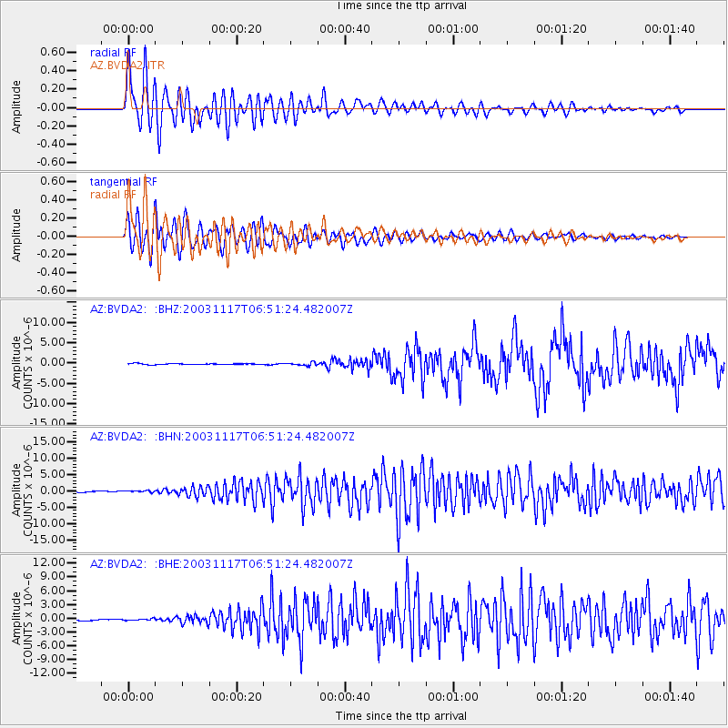
Earthquake location: Rat Islands, Aleutian Islands
Earthquake latitude/longitude: 51.1/178.6
Earthquake time(UTC): 2003/11/17 (321) 06:43:06 GMT
Earthquake Depth: 33 km
Earthquake Magnitude: 6.2 MB, 7.2 MS, 7.8 MW, 7.7 MW
Earthquake Catalog/Contributor: WHDF/NEIC
Network: AZ ANZA Regional Network
Station: BVDA2 AZ.BVDA2
Lat/Lon: 33.33 N/116.37 W
Elevation: 0.0 m
Distance: 49.6 deg
Az: 84.768 deg
Baz: 311.478 deg
Ray Param: 0.06851619
Estimated Moho Depth: 21.75 km
Estimated Crust Vp/Vs: 1.83
Assumed Crust Vp: 6.264 km/s
Estimated Crust Vs: 3.427 km/s
Estimated Crust Poisson's Ratio: 0.29
Radial Match: 90.422844 %
Radial Bump: 400
Transverse Match: 89.94831 %
Transverse Bump: 400
SOD ConfigId: 32974
Insert Time: 2010-02-26 18:38:17.324 +0000
GWidth: 2.5
Max Bumps: 400
Tol: 0.001

Signal To Noise

ChannelStoNSTALTA
AZ:BVDA2: :BHN:20031117T06:51:24.482007Z1.17724422.0797157E-71.7665967E-7
AZ:BVDA2: :BHE:20031117T06:51:24.482007Z1.31701641.8987616E-71.4417145E-7
AZ:BVDA2: :BHZ:20031117T06:51:24.482007Z3.32260663.9376727E-71.1851155E-7
Arrivals
Ps3.0 SECOND
PpPs9.3 SECOND
PsPs/PpSs12 SECOND