You are here: Home > Network List > AV - Alaska Volcano Observatory Stations List
> Station MAPS Pakushin Southeast, Makushin Volcano, Alaska > Earthquake Result Viewer
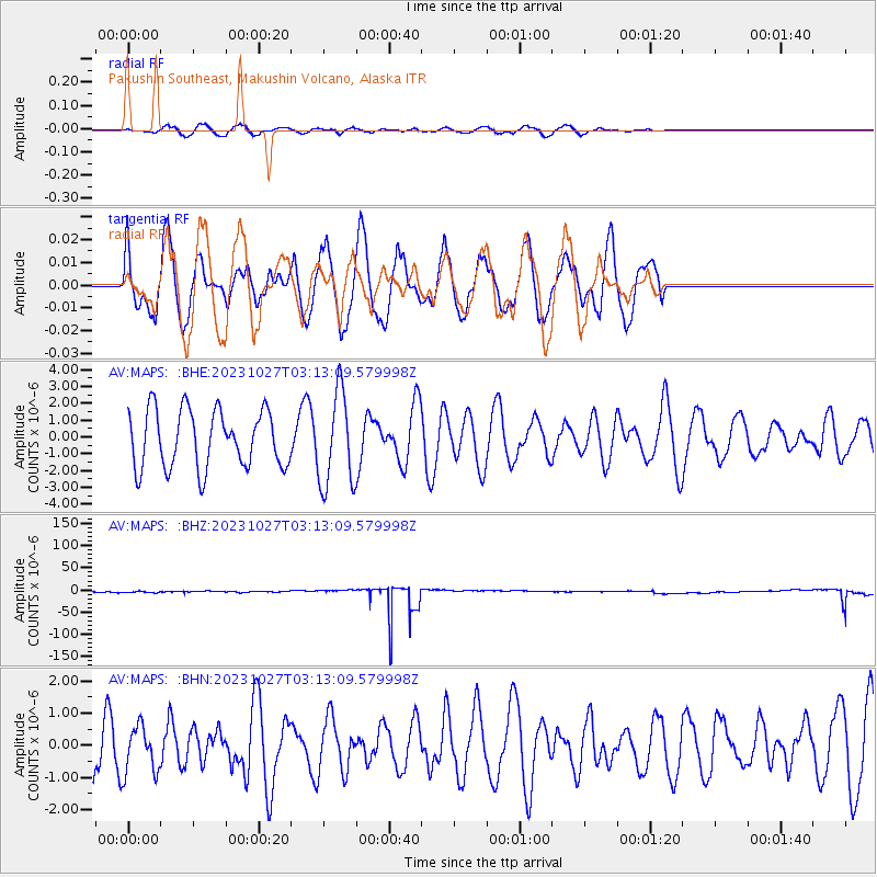
MAPS Pakushin Southeast, Makushin Volcano, Alaska - Earthquake Result Viewer
*The percent match for this event was below the threshold and hence no stack was calculated.
| Earthquake location: |
Tonga Islands |
| Earthquake latitude/longitude: |
-17.6/-173.8 |
| Earthquake time(UTC): |
2023/10/27 (300) 03:02:24 GMT |
| Earthquake Depth: |
35 km |
| Earthquake Magnitude: |
5.6 mb |
| Earthquake Catalog/Contributor: |
NEIC PDE/us |
|
| Network: |
AV Alaska Volcano Observatory |
| Station: |
MAPS Pakushin Southeast, Makushin Volcano, Alaska |
| Lat/Lon: |
53.81 N/166.94 W |
| Elevation: |
333 m |
|
| Distance: |
71.3 deg |
| Az: |
4.268 deg |
| Baz: |
186.875 deg |
| Ray Param: |
$rayparam |
*The percent match for this event was below the threshold and hence was not used in the summary stack. |
|
| Radial Match: |
64.05803 % |
| Radial Bump: |
307 |
| Transverse Match: |
25.333075 % |
| Transverse Bump: |
325 |
| SOD ConfigId: |
31937991 |
| Insert Time: |
2023-11-10 03:09:46.142 +0000 |
| GWidth: |
2.5 |
| Max Bumps: |
400 |
| Tol: |
0.001 |
|
Signal To Noise
| Channel | StoN | STA | LTA |
| AV:MAPS: :BHZ:20231027T03:13:09.579998Z | 0.11081578 | 1.6060727E-6 | 1.4493177E-5 |
| AV:MAPS: :BHN:20231027T03:13:09.579998Z | 0.7651328 | 7.3064155E-7 | 9.549212E-7 |
| AV:MAPS: :BHE:20231027T03:13:09.579998Z | 1.6333784 | 2.7827505E-6 | 1.7036778E-6 |
| Arrivals |
| Ps | |
| PpPs | |
| PsPs/PpSs | |


