You are here: Home > Network List > US - United States National Seismic Network Stations List
> Station AMTX Amarillo, Texas, USA > Earthquake Result Viewer
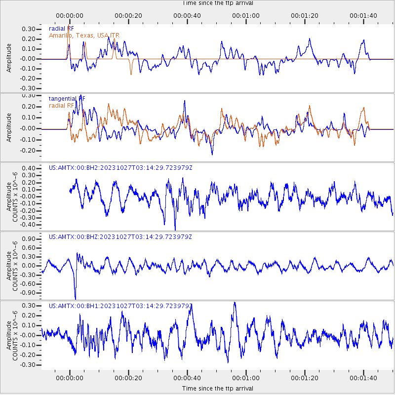
AMTX Amarillo, Texas, USA - Earthquake Result Viewer
*The percent match for this event was below the threshold and hence no stack was calculated.
| Earthquake location: |
Tonga Islands |
| Earthquake latitude/longitude: |
-17.6/-173.8 |
| Earthquake time(UTC): |
2023/10/27 (300) 03:02:24 GMT |
| Earthquake Depth: |
35 km |
| Earthquake Magnitude: |
5.6 mb |
| Earthquake Catalog/Contributor: |
NEIC PDE/us |
|
| Network: |
US United States National Seismic Network |
| Station: |
AMTX Amarillo, Texas, USA |
| Lat/Lon: |
34.53 N/101.41 W |
| Elevation: |
1010 m |
|
| Distance: |
86.0 deg |
| Az: |
52.062 deg |
| Baz: |
245.67 deg |
| Ray Param: |
$rayparam |
*The percent match for this event was below the threshold and hence was not used in the summary stack. |
|
| Radial Match: |
53.87813 % |
| Radial Bump: |
400 |
| Transverse Match: |
53.711197 % |
| Transverse Bump: |
400 |
| SOD ConfigId: |
31937991 |
| Insert Time: |
2023-11-10 03:27:52.846 +0000 |
| GWidth: |
2.5 |
| Max Bumps: |
400 |
| Tol: |
0.001 |
|
Signal To Noise
| Channel | StoN | STA | LTA |
| US:AMTX:00:BHZ:20231027T03:14:29.723979Z | 2.9947078 | 3.7514982E-7 | 1.2527092E-7 |
| US:AMTX:00:BH1:20231027T03:14:29.723979Z | 1.6454291 | 1.0240473E-7 | 6.223588E-8 |
| US:AMTX:00:BH2:20231027T03:14:29.723979Z | 1.4136066 | 1.7226196E-7 | 1.218599E-7 |
| Arrivals |
| Ps | |
| PpPs | |
| PsPs/PpSs | |


