You are here: Home > Network List > US - United States National Seismic Network Stations List
> Station HAWA Hanford, Washington, USA > Earthquake Result Viewer
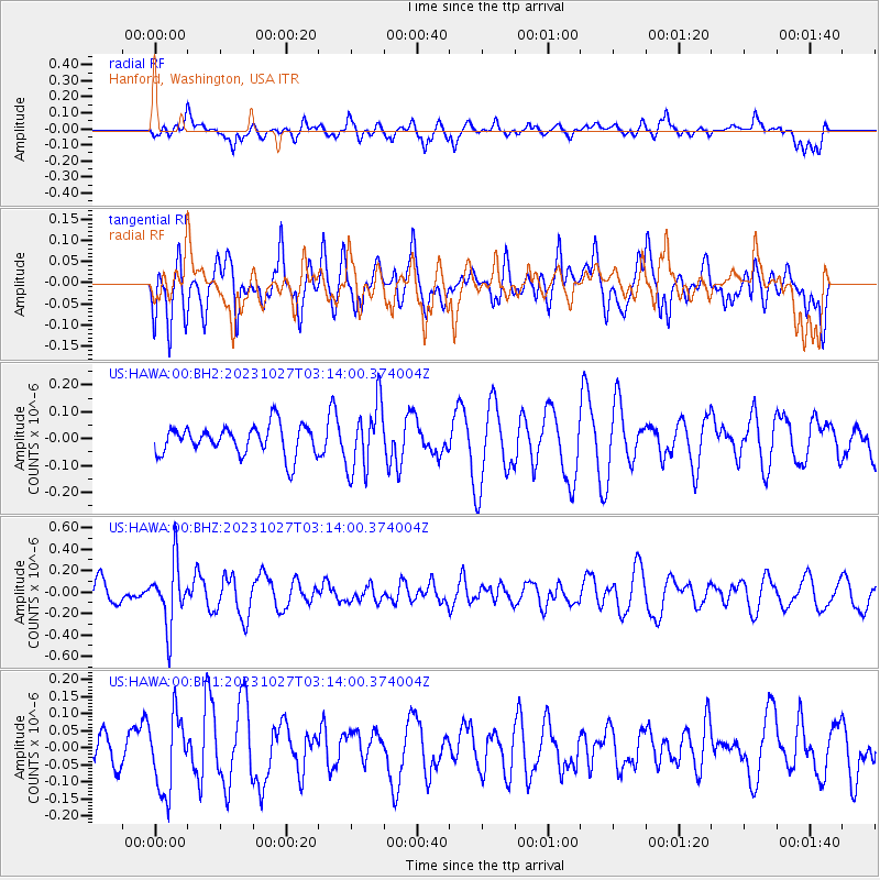
HAWA Hanford, Washington, USA - Earthquake Result Viewer
*The percent match for this event was below the threshold and hence no stack was calculated.
| Earthquake location: |
Tonga Islands |
| Earthquake latitude/longitude: |
-17.6/-173.8 |
| Earthquake time(UTC): |
2023/10/27 (300) 03:02:24 GMT |
| Earthquake Depth: |
35 km |
| Earthquake Magnitude: |
5.6 mb |
| Earthquake Catalog/Contributor: |
NEIC PDE/us |
|
| Network: |
US United States National Seismic Network |
| Station: |
HAWA Hanford, Washington, USA |
| Lat/Lon: |
46.39 N/119.53 W |
| Elevation: |
364 m |
|
| Distance: |
80.3 deg |
| Az: |
34.739 deg |
| Baz: |
231.749 deg |
| Ray Param: |
$rayparam |
*The percent match for this event was below the threshold and hence was not used in the summary stack. |
|
| Radial Match: |
58.79617 % |
| Radial Bump: |
400 |
| Transverse Match: |
49.751713 % |
| Transverse Bump: |
400 |
| SOD ConfigId: |
31937991 |
| Insert Time: |
2023-11-10 03:28:06.967 +0000 |
| GWidth: |
2.5 |
| Max Bumps: |
400 |
| Tol: |
0.001 |
|
Signal To Noise
| Channel | StoN | STA | LTA |
| US:HAWA:00:BHZ:20231027T03:14:00.374004Z | 2.5180764 | 2.9214968E-7 | 1.1602098E-7 |
| US:HAWA:00:BH1:20231027T03:14:00.374004Z | 1.7292209 | 1.10075014E-7 | 6.365585E-8 |
| US:HAWA:00:BH2:20231027T03:14:00.374004Z | 2.2496948 | 1.2385384E-7 | 5.505361E-8 |
| Arrivals |
| Ps | |
| PpPs | |
| PsPs/PpSs | |


