You are here: Home > Network List > UW - Pacific Northwest Regional Seismic Network Stations List
> Station DAVN Davenport, WA, USA > Earthquake Result Viewer
DAVN Davenport, WA, USA - Earthquake Result Viewer
*The percent match for this event was below the threshold and hence no stack was calculated.
| Earthquake location: |
Tonga Islands |
| Earthquake latitude/longitude: |
-17.6/-173.8 |
| Earthquake time(UTC): |
2023/10/27 (300) 03:02:24 GMT |
| Earthquake Depth: |
35 km |
| Earthquake Magnitude: |
5.6 mb |
| Earthquake Catalog/Contributor: |
NEIC PDE/us |
|
| Network: |
UW Pacific Northwest Regional Seismic Network |
| Station: |
DAVN Davenport, WA, USA |
| Lat/Lon: |
47.80 N/118.27 W |
| Elevation: |
483 m |
|
| Distance: |
81.8 deg |
| Az: |
34.147 deg |
| Baz: |
232.576 deg |
| Ray Param: |
$rayparam |
*The percent match for this event was below the threshold and hence was not used in the summary stack. |
|
| Radial Match: |
63.785744 % |
| Radial Bump: |
381 |
| Transverse Match: |
66.22184 % |
| Transverse Bump: |
400 |
| SOD ConfigId: |
31937991 |
| Insert Time: |
2023-11-10 03:29:41.679 +0000 |
| GWidth: |
2.5 |
| Max Bumps: |
400 |
| Tol: |
0.001 |
|
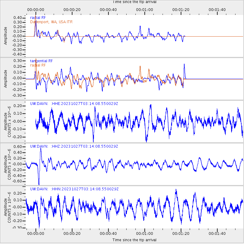
Signal To Noise
| Channel | StoN | STA | LTA |
| UW:DAVN: :HHZ:20231027T03:14:08.550029Z | 2.3759108 | 2.865772E-7 | 1.2061783E-7 |
| UW:DAVN: :HHN:20231027T03:14:08.550029Z | 1.8161507 | 1.074915E-7 | 5.9186448E-8 |
| UW:DAVN: :HHE:20231027T03:14:08.550029Z | 1.3267487 | 9.347096E-8 | 7.045114E-8 |
| Arrivals |
| Ps | |
| PpPs | |
| PsPs/PpSs | |


