You are here: Home > Network List > UW - Pacific Northwest Regional Seismic Network Stations List
> Station HOOD Mt Hood Meadows, OR CREST BB SMO > Earthquake Result Viewer
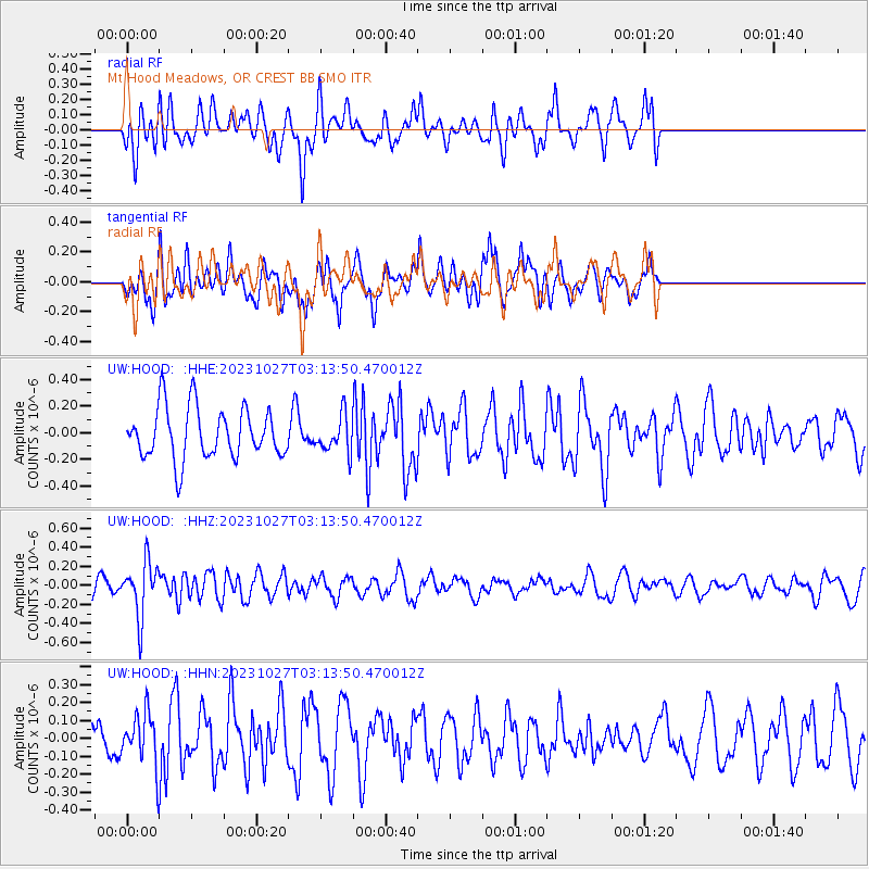
HOOD Mt Hood Meadows, OR CREST BB SMO - Earthquake Result Viewer
*The percent match for this event was below the threshold and hence no stack was calculated.
| Earthquake location: |
Tonga Islands |
| Earthquake latitude/longitude: |
-17.6/-173.8 |
| Earthquake time(UTC): |
2023/10/27 (300) 03:02:24 GMT |
| Earthquake Depth: |
35 km |
| Earthquake Magnitude: |
5.6 mb |
| Earthquake Catalog/Contributor: |
NEIC PDE/us |
|
| Network: |
UW Pacific Northwest Regional Seismic Network |
| Station: |
HOOD Mt Hood Meadows, OR CREST BB SMO |
| Lat/Lon: |
45.32 N/121.65 W |
| Elevation: |
1520 m |
|
| Distance: |
78.4 deg |
| Az: |
34.636 deg |
| Baz: |
230.213 deg |
| Ray Param: |
$rayparam |
*The percent match for this event was below the threshold and hence was not used in the summary stack. |
|
| Radial Match: |
55.204716 % |
| Radial Bump: |
400 |
| Transverse Match: |
59.200844 % |
| Transverse Bump: |
400 |
| SOD ConfigId: |
31937991 |
| Insert Time: |
2023-11-10 03:30:10.461 +0000 |
| GWidth: |
2.5 |
| Max Bumps: |
400 |
| Tol: |
0.001 |
|
Signal To Noise
| Channel | StoN | STA | LTA |
| UW:HOOD: :HHZ:20231027T03:13:50.470012Z | 2.736867 | 2.8797245E-7 | 1.0521975E-7 |
| UW:HOOD: :HHN:20231027T03:13:50.470012Z | 1.4518558 | 1.4218061E-7 | 9.793026E-8 |
| UW:HOOD: :HHE:20231027T03:13:50.470012Z | 0.7135491 | 1.3639257E-7 | 1.9114673E-7 |
| Arrivals |
| Ps | |
| PpPs | |
| PsPs/PpSs | |


