You are here: Home > Network List > WW - Idaho Seismic Network () Stations List
> Station BILL Emerald Creek, Idaho > Earthquake Result Viewer
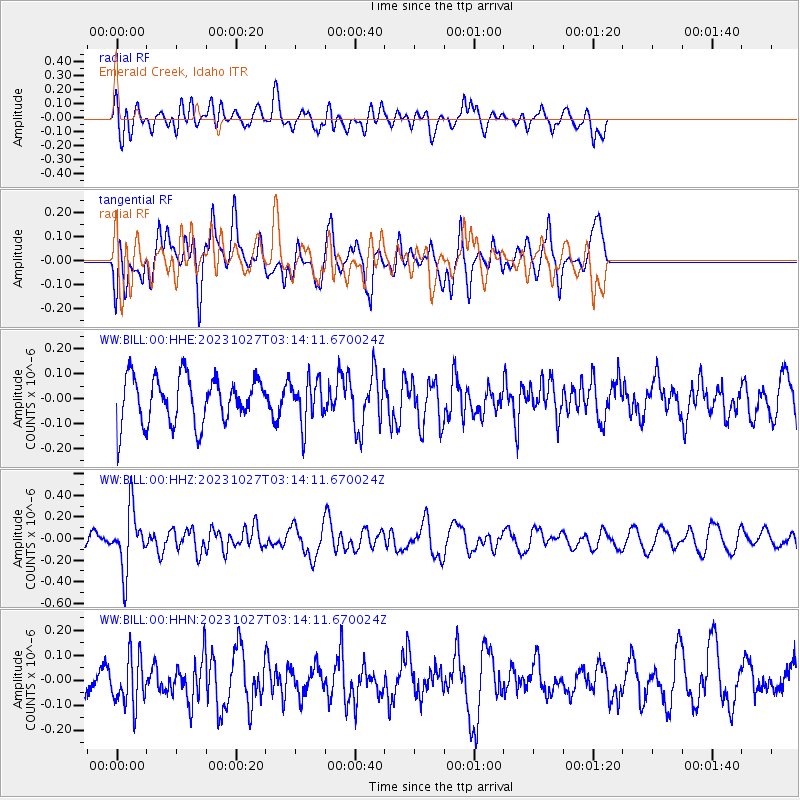
BILL Emerald Creek, Idaho - Earthquake Result Viewer
*The percent match for this event was below the threshold and hence no stack was calculated.
| Earthquake location: |
Tonga Islands |
| Earthquake latitude/longitude: |
-17.6/-173.8 |
| Earthquake time(UTC): |
2023/10/27 (300) 03:02:24 GMT |
| Earthquake Depth: |
35 km |
| Earthquake Magnitude: |
5.6 mb |
| Earthquake Catalog/Contributor: |
NEIC PDE/us |
|
| Network: |
WW Idaho Seismic Network () |
| Station: |
BILL Emerald Creek, Idaho |
| Lat/Lon: |
47.03 N/116.34 W |
| Elevation: |
866 m |
|
| Distance: |
82.4 deg |
| Az: |
35.561 deg |
| Baz: |
234.191 deg |
| Ray Param: |
$rayparam |
*The percent match for this event was below the threshold and hence was not used in the summary stack. |
|
| Radial Match: |
58.428772 % |
| Radial Bump: |
400 |
| Transverse Match: |
69.56295 % |
| Transverse Bump: |
400 |
| SOD ConfigId: |
31937991 |
| Insert Time: |
2023-11-10 03:32:12.328 +0000 |
| GWidth: |
2.5 |
| Max Bumps: |
400 |
| Tol: |
0.001 |
|
Signal To Noise
| Channel | StoN | STA | LTA |
| WW:BILL:00:HHZ:20231027T03:14:11.670024Z | 3.4648523 | 2.7406705E-7 | 7.90992E-8 |
| WW:BILL:00:HHN:20231027T03:14:11.670024Z | 1.5981437 | 9.904743E-8 | 6.197655E-8 |
| WW:BILL:00:HHE:20231027T03:14:11.670024Z | 0.95359 | 9.049723E-8 | 9.4901615E-8 |
| Arrivals |
| Ps | |
| PpPs | |
| PsPs/PpSs | |


