You are here: Home > Network List > TA - USArray Transportable Network (new EarthScope stations) Stations List
> Station F27A Lemmon, SD, USA > Earthquake Result Viewer
F27A Lemmon, SD, USA - Earthquake Result Viewer

| Earthquake location: |
Off East Coast Of Kamchatka |
| Earthquake latitude/longitude: |
52.5/159.8 |
| Earthquake time(UTC): |
2010/07/30 (211) 03:56:13 GMT |
| Earthquake Depth: |
23 km |
| Earthquake Magnitude: |
6.1 MB, 6.3 MS, 6.3 MW, 6.3 MW |
| Earthquake Catalog/Contributor: |
WHDF/NEIC |
|
| Network: |
TA USArray Transportable Network (new EarthScope stations) |
| Station: |
F27A Lemmon, SD, USA |
| Lat/Lon: |
45.87 N/102.02 W |
| Elevation: |
757 m |
|
| Distance: |
59.6 deg |
| Az: |
53.293 deg |
| Baz: |
315.45 deg |
| Ray Param: |
0.06203696 |
| Estimated Moho Depth: |
61.75 km |
| Estimated Crust Vp/Vs: |
1.60 |
| Assumed Crust Vp: |
6.242 km/s |
| Estimated Crust Vs: |
3.901 km/s |
| Estimated Crust Poisson's Ratio: |
0.18 |
|
| Radial Match: |
80.062805 % |
| Radial Bump: |
357 |
| Transverse Match: |
68.8907 % |
| Transverse Bump: |
400 |
| SOD ConfigId: |
319893 |
| Insert Time: |
2011-01-05 14:44:40.173 +0000 |
| GWidth: |
2.5 |
| Max Bumps: |
400 |
| Tol: |
0.001 |
|
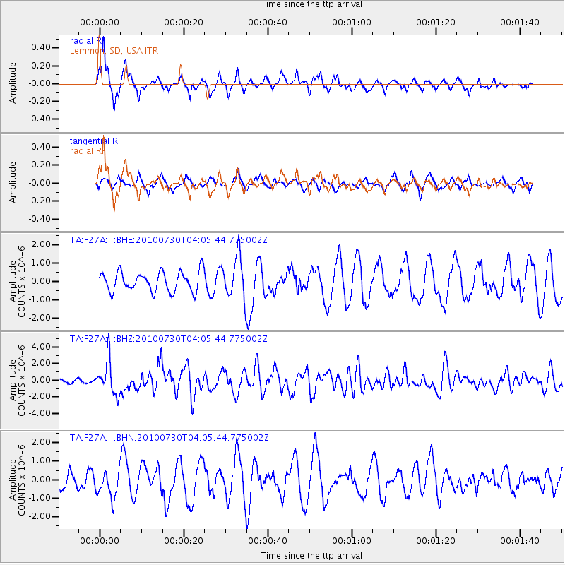
Signal To Noise
| Channel | StoN | STA | LTA |
| TA:F27A: :BHZ:20100730T04:05:44.775002Z | 10.964745 | 2.1073477E-6 | 1.9219306E-7 |
| TA:F27A: :BHN:20100730T04:05:44.775002Z | 1.7630953 | 7.4260413E-7 | 4.2119345E-7 |
| TA:F27A: :BHE:20100730T04:05:44.775002Z | 2.138234 | 1.1381595E-6 | 5.3228956E-7 |
| Arrivals |
| Ps | 6.2 SECOND |
| PpPs | 24 SECOND |
| PsPs/PpSs | 31 SECOND |


