You are here: Home > Network List > US - United States National Seismic Network Stations List
> Station HAWA Hanford, Washington, USA > Earthquake Result Viewer
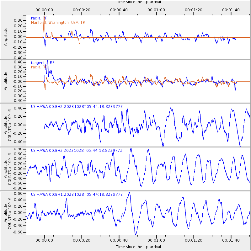
HAWA Hanford, Washington, USA - Earthquake Result Viewer
*The percent match for this event was below the threshold and hence no stack was calculated.
| Earthquake location: |
Solomon Islands |
| Earthquake latitude/longitude: |
-10.2/161.3 |
| Earthquake time(UTC): |
2023/10/28 (301) 05:31:58 GMT |
| Earthquake Depth: |
69 km |
| Earthquake Magnitude: |
5.5 mww |
| Earthquake Catalog/Contributor: |
NEIC PDE/us |
|
| Network: |
US United States National Seismic Network |
| Station: |
HAWA Hanford, Washington, USA |
| Lat/Lon: |
46.39 N/119.53 W |
| Elevation: |
364 m |
|
| Distance: |
90.0 deg |
| Az: |
42.829 deg |
| Baz: |
255.194 deg |
| Ray Param: |
$rayparam |
*The percent match for this event was below the threshold and hence was not used in the summary stack. |
|
| Radial Match: |
38.412975 % |
| Radial Bump: |
400 |
| Transverse Match: |
78.80164 % |
| Transverse Bump: |
400 |
| SOD ConfigId: |
31937991 |
| Insert Time: |
2023-11-11 05:48:33.478 +0000 |
| GWidth: |
2.5 |
| Max Bumps: |
400 |
| Tol: |
0.001 |
|
Signal To Noise
| Channel | StoN | STA | LTA |
| US:HAWA:00:BHZ:20231028T05:44:18.823977Z | 1.7747523 | 2.0187063E-7 | 1.1374581E-7 |
| US:HAWA:00:BH1:20231028T05:44:18.823977Z | 0.556756 | 4.327836E-8 | 7.773308E-8 |
| US:HAWA:00:BH2:20231028T05:44:18.823977Z | 2.1331685 | 1.8161415E-7 | 8.513821E-8 |
| Arrivals |
| Ps | |
| PpPs | |
| PsPs/PpSs | |


