You are here: Home > Network List > GS - US Geological Survey Networks Stations List
> Station KAN13 Rinehart Farm > Earthquake Result Viewer
KAN13 Rinehart Farm - Earthquake Result Viewer
*The percent match for this event was below the threshold and hence no stack was calculated.
| Earthquake location: |
Near Coast Of Ecuador |
| Earthquake latitude/longitude: |
-2.4/-79.9 |
| Earthquake time(UTC): |
2019/02/04 (035) 17:45:47 GMT |
| Earthquake Depth: |
70 km |
| Earthquake Magnitude: |
5.8 Mww |
| Earthquake Catalog/Contributor: |
NEIC PDE/us |
|
| Network: |
GS US Geological Survey Networks |
| Station: |
KAN13 Rinehart Farm |
| Lat/Lon: |
37.01 N/97.48 W |
| Elevation: |
340 m |
|
| Distance: |
42.5 deg |
| Az: |
339.005 deg |
| Baz: |
153.436 deg |
| Ray Param: |
$rayparam |
*The percent match for this event was below the threshold and hence was not used in the summary stack. |
|
| Radial Match: |
36.19029 % |
| Radial Bump: |
400 |
| Transverse Match: |
43.779858 % |
| Transverse Bump: |
400 |
| SOD ConfigId: |
3287751 |
| Insert Time: |
2019-02-18 18:06:29.009 +0000 |
| GWidth: |
2.5 |
| Max Bumps: |
400 |
| Tol: |
0.001 |
|
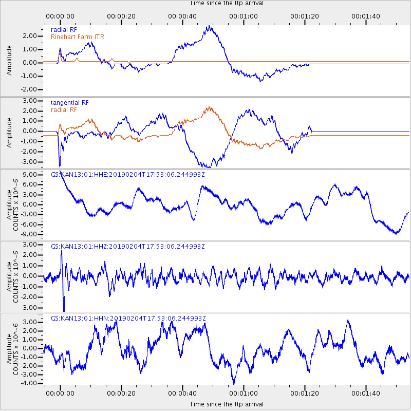
Signal To Noise
| Channel | StoN | STA | LTA |
| GS:KAN13:01:HHZ:20190204T17:53:06.244993Z | 5.125181 | 1.1778212E-6 | 2.2981064E-7 |
| GS:KAN13:01:HHN:20190204T17:53:06.244993Z | 1.040321 | 1.1747625E-6 | 1.1292308E-6 |
| GS:KAN13:01:HHE:20190204T17:53:06.244993Z | 0.39720094 | 1.2210188E-6 | 3.074058E-6 |
| Arrivals |
| Ps | |
| PpPs | |
| PsPs/PpSs | |


