BVDA2 AZ.BVDA2 - Earthquake Result Viewer
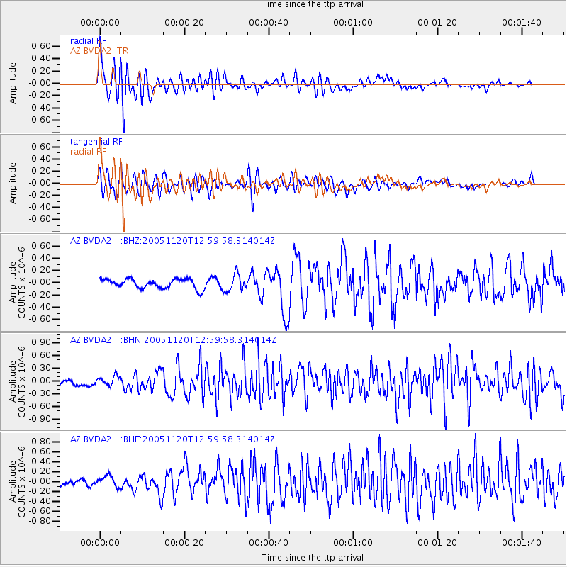
Earthquake location: Unimak Island Region, Alaska
Earthquake latitude/longitude: 53.8/-164.1
Earthquake time(UTC): 2005/11/20 (324) 12:53:02 GMT
Earthquake Depth: 30 km
Earthquake Magnitude: 5.7 MB, 5.8 MS, 6.2 MW, 6.0 MW
Earthquake Catalog/Contributor: WHDF/NEIC
Network: AZ ANZA Regional Network
Station: BVDA2 AZ.BVDA2
Lat/Lon: 33.33 N/116.37 W
Elevation: 0.0 m
Distance: 39.3 deg
Az: 101.816 deg
Baz: 316.149 deg
Ray Param: 0.075028695
Estimated Moho Depth: 26.75 km
Estimated Crust Vp/Vs: 1.75
Assumed Crust Vp: 6.264 km/s
Estimated Crust Vs: 3.579 km/s
Estimated Crust Poisson's Ratio: 0.26
Radial Match: 83.253815 %
Radial Bump: 400
Transverse Match: 79.73063 %
Transverse Bump: 400
SOD ConfigId: 2669
Insert Time: 2010-02-26 18:38:40.011 +0000
GWidth: 2.5
Max Bumps: 400
Tol: 0.001

Signal To Noise

ChannelStoNSTALTA
AZ:BVDA2: :BHN:20051120T12:59:58.314014Z1.33736431.0943005E-78.1825156E-8
AZ:BVDA2: :BHE:20051120T12:59:58.314014Z2.38673041.1205126E-74.6947598E-8
AZ:BVDA2: :BHZ:20051120T12:59:58.314014Z1.81620861.391764E-77.663018E-8
Arrivals
Ps3.4 SECOND
PpPs11 SECOND
PsPs/PpSs14 SECOND