
BVDA2 AZ.BVDA2 - Earthquake Result Viewer
| ||||||||||||||||||
| ||||||||||||||||||
| ||||||||||||||||||
|
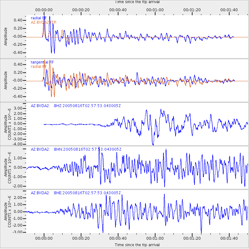
Signal To Noise
| Channel | StoN | STA | LTA |
| AZ:BVDA2: :BHN:20050816T02:57:53.043005Z | 1.204209 | 8.911473E-8 | 7.400271E-8 |
| AZ:BVDA2: :BHE:20050816T02:57:53.043005Z | 1.3157275 | 7.0781084E-8 | 5.379616E-8 |
| AZ:BVDA2: :BHZ:20050816T02:57:53.043005Z | 5.5203824 | 2.7844172E-7 | 5.0438846E-8 |
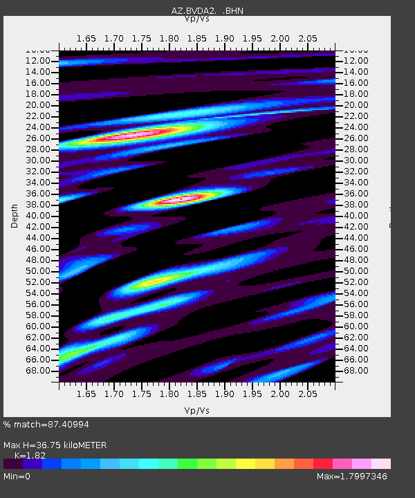
| Arrivals | |
| Ps | 4.9 SECOND |
| PpPs | 16 SECOND |
| PsPs/PpSs | 21 SECOND |

