BVDA2 AZ.BVDA2 - Earthquake Result Viewer
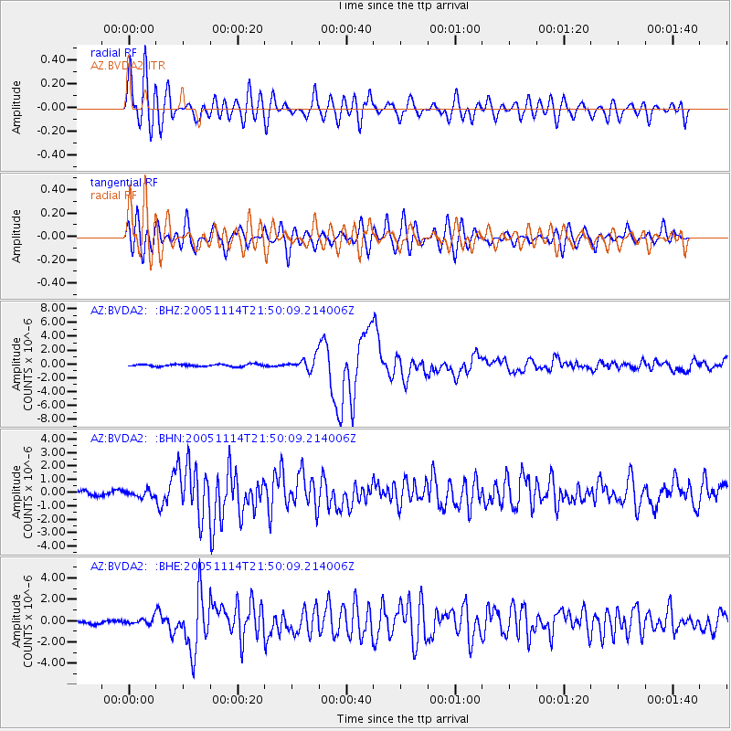
Earthquake location: Off East Coast Of Honshu, Japan
Earthquake latitude/longitude: 38.1/144.9
Earthquake time(UTC): 2005/11/14 (318) 21:38:51 GMT
Earthquake Depth: 11 km
Earthquake Magnitude: 6.7 MB, 6.8 MS, 7.0 MW, 6.9 MW
Earthquake Catalog/Contributor: WHDF/NEIC
Network: AZ ANZA Regional Network
Station: BVDA2 AZ.BVDA2
Lat/Lon: 33.33 N/116.37 W
Elevation: 0.0 m
Distance: 76.4 deg
Az: 58.377 deg
Baz: 306.648 deg
Ray Param: 0.051040877
Estimated Moho Depth: 22.0 km
Estimated Crust Vp/Vs: 1.89
Assumed Crust Vp: 6.264 km/s
Estimated Crust Vs: 3.318 km/s
Estimated Crust Poisson's Ratio: 0.30
Radial Match: 91.202484 %
Radial Bump: 400
Transverse Match: 84.397194 %
Transverse Bump: 400
SOD ConfigId: 2448
Insert Time: 2010-02-26 18:38:49.245 +0000
GWidth: 2.5
Max Bumps: 400
Tol: 0.001

Signal To Noise

ChannelStoNSTALTA
AZ:BVDA2: :BHN:20051114T21:50:09.214006Z1.05989192.4194918E-72.2827723E-7
AZ:BVDA2: :BHE:20051114T21:50:09.214006Z2.03526762.78696E-71.3693335E-7
AZ:BVDA2: :BHZ:20051114T21:50:09.214006Z5.64841139.4446705E-71.6720932E-7
Arrivals
Ps3.2 SECOND
PpPs9.9 SECOND
PsPs/PpSs13 SECOND