You are here: Home > Network List > US - United States National Seismic Network Stations List
> Station HAWA Hanford, Washington, USA > Earthquake Result Viewer
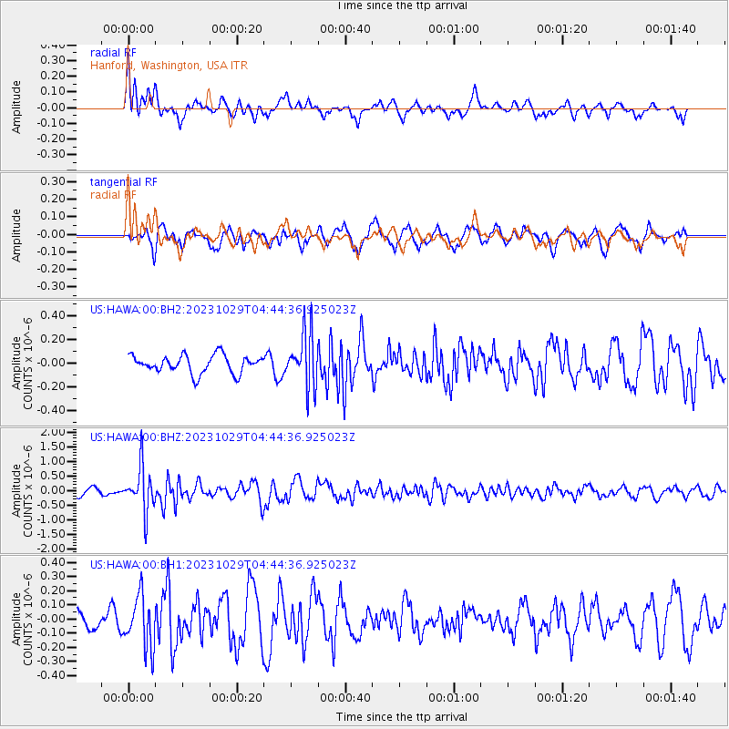
HAWA Hanford, Washington, USA - Earthquake Result Viewer
*The percent match for this event was below the threshold and hence no stack was calculated.
| Earthquake location: |
Vanuatu Islands |
| Earthquake latitude/longitude: |
-19.4/168.8 |
| Earthquake time(UTC): |
2023/10/29 (302) 04:32:08 GMT |
| Earthquake Depth: |
80 km |
| Earthquake Magnitude: |
6.0 mww |
| Earthquake Catalog/Contributor: |
NEIC PDE/us |
|
| Network: |
US United States National Seismic Network |
| Station: |
HAWA Hanford, Washington, USA |
| Lat/Lon: |
46.39 N/119.53 W |
| Elevation: |
364 m |
|
| Distance: |
91.9 deg |
| Az: |
41.109 deg |
| Baz: |
243.712 deg |
| Ray Param: |
$rayparam |
*The percent match for this event was below the threshold and hence was not used in the summary stack. |
|
| Radial Match: |
68.2204 % |
| Radial Bump: |
367 |
| Transverse Match: |
73.752014 % |
| Transverse Bump: |
400 |
| SOD ConfigId: |
31937991 |
| Insert Time: |
2023-11-12 04:54:59.884 +0000 |
| GWidth: |
2.5 |
| Max Bumps: |
400 |
| Tol: |
0.001 |
|
Signal To Noise
| Channel | StoN | STA | LTA |
| US:HAWA:00:BHZ:20231029T04:44:36.925023Z | 5.0061107 | 7.7386045E-7 | 1.5458318E-7 |
| US:HAWA:00:BH1:20231029T04:44:36.925023Z | 2.106301 | 1.8432765E-7 | 8.751249E-8 |
| US:HAWA:00:BH2:20231029T04:44:36.925023Z | 3.0053148 | 2.2791842E-7 | 7.583845E-8 |
| Arrivals |
| Ps | |
| PpPs | |
| PsPs/PpSs | |


