You are here: Home > Network List > AZ - ANZA Regional Network Stations List
> Station BVDA2 AZ.BVDA2 > Earthquake Result Viewer
BVDA2 AZ.BVDA2 - Earthquake Result Viewer

| Earthquake location: |
East Of Kuril Islands |
| Earthquake latitude/longitude: |
46.2/154.5 |
| Earthquake time(UTC): |
2007/01/13 (013) 04:23:21 GMT |
| Earthquake Depth: |
10 km |
| Earthquake Magnitude: |
7.3 MB, 8.2 MS, 8.1 MW, 7.9 MW |
| Earthquake Catalog/Contributor: |
WHDF/NEIC |
|
| Network: |
AZ ANZA Regional Network |
| Station: |
BVDA2 AZ.BVDA2 |
| Lat/Lon: |
33.33 N/116.37 W |
| Elevation: |
0.0 m |
|
| Distance: |
66.3 deg |
| Az: |
66.147 deg |
| Baz: |
310.7 deg |
| Ray Param: |
0.05773812 |
| Estimated Moho Depth: |
21.75 km |
| Estimated Crust Vp/Vs: |
1.90 |
| Assumed Crust Vp: |
6.264 km/s |
| Estimated Crust Vs: |
3.292 km/s |
| Estimated Crust Poisson's Ratio: |
0.31 |
|
| Radial Match: |
89.36873 % |
| Radial Bump: |
400 |
| Transverse Match: |
84.30396 % |
| Transverse Bump: |
400 |
| SOD ConfigId: |
2564 |
| Insert Time: |
2010-02-26 18:38:59.091 +0000 |
| GWidth: |
2.5 |
| Max Bumps: |
400 |
| Tol: |
0.001 |
|
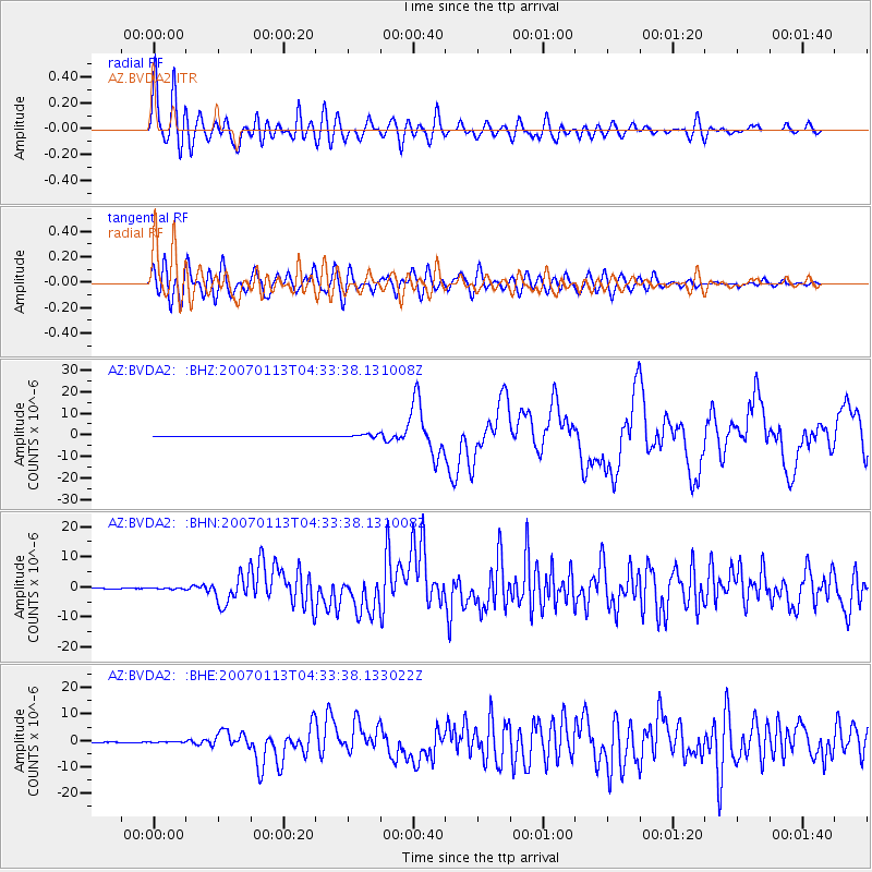
Signal To Noise
| Channel | StoN | STA | LTA |
| AZ:BVDA2: :BHN:20070113T04:33:38.131008Z | 1.2728426 | 1.8261771E-7 | 1.4347233E-7 |
| AZ:BVDA2: :BHE:20070113T04:33:38.133022Z | 1.7136642 | 2.079762E-7 | 1.2136346E-7 |
| AZ:BVDA2: :BHZ:20070113T04:33:38.131008Z | 10.043261 | 7.910273E-7 | 7.8762E-8 |
| Arrivals |
| Ps | 3.2 SECOND |
| PpPs | 9.7 SECOND |
| PsPs/PpSs | 13 SECOND |


