You are here: Home > Network List > UW - Pacific Northwest Regional Seismic Network Stations List
> Station IRON Crane, OR, USA > Earthquake Result Viewer
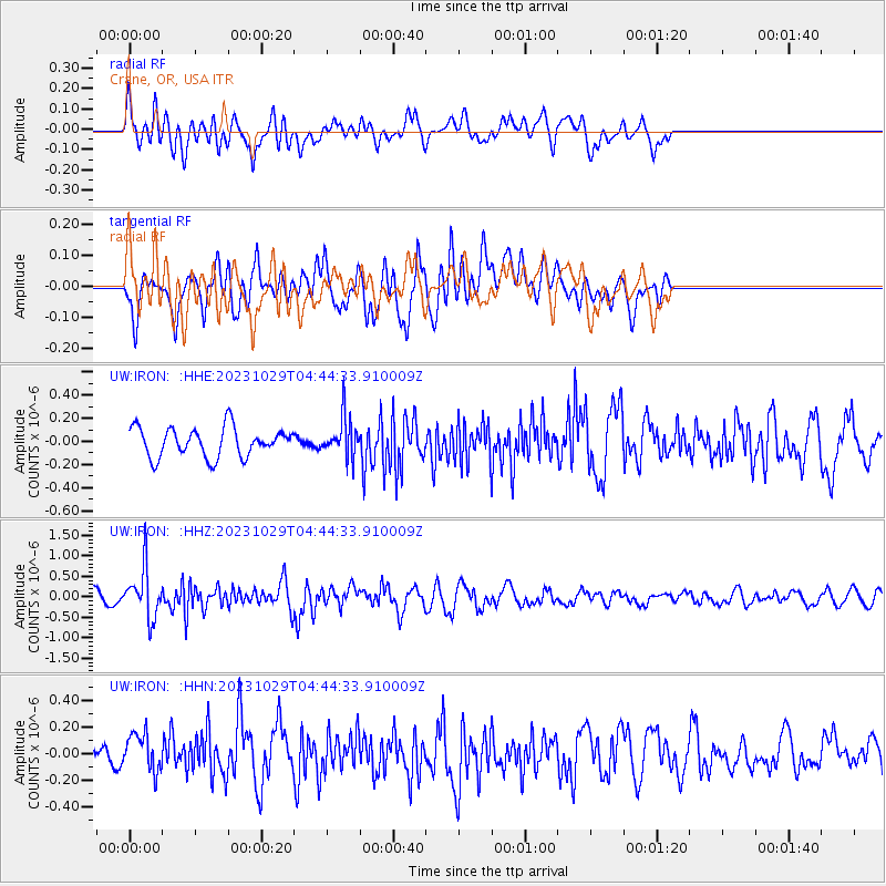
IRON Crane, OR, USA - Earthquake Result Viewer
*The percent match for this event was below the threshold and hence no stack was calculated.
| Earthquake location: |
Vanuatu Islands |
| Earthquake latitude/longitude: |
-19.4/168.8 |
| Earthquake time(UTC): |
2023/10/29 (302) 04:32:08 GMT |
| Earthquake Depth: |
80 km |
| Earthquake Magnitude: |
6.0 mww |
| Earthquake Catalog/Contributor: |
NEIC PDE/us |
|
| Network: |
UW Pacific Northwest Regional Seismic Network |
| Station: |
IRON Crane, OR, USA |
| Lat/Lon: |
43.36 N/118.47 W |
| Elevation: |
1226 m |
|
| Distance: |
91.3 deg |
| Az: |
44.167 deg |
| Baz: |
244.372 deg |
| Ray Param: |
$rayparam |
*The percent match for this event was below the threshold and hence was not used in the summary stack. |
|
| Radial Match: |
55.826805 % |
| Radial Bump: |
400 |
| Transverse Match: |
56.14328 % |
| Transverse Bump: |
400 |
| SOD ConfigId: |
31937991 |
| Insert Time: |
2023-11-12 04:57:14.237 +0000 |
| GWidth: |
2.5 |
| Max Bumps: |
400 |
| Tol: |
0.001 |
|
Signal To Noise
| Channel | StoN | STA | LTA |
| UW:IRON: :HHZ:20231029T04:44:33.910009Z | 4.6960006 | 5.956774E-7 | 1.2684781E-7 |
| UW:IRON: :HHN:20231029T04:44:33.910009Z | 1.3228798 | 1.3996733E-7 | 1.0580502E-7 |
| UW:IRON: :HHE:20231029T04:44:33.910009Z | 1.3458359 | 1.701481E-7 | 1.2642559E-7 |
| Arrivals |
| Ps | |
| PpPs | |
| PsPs/PpSs | |


