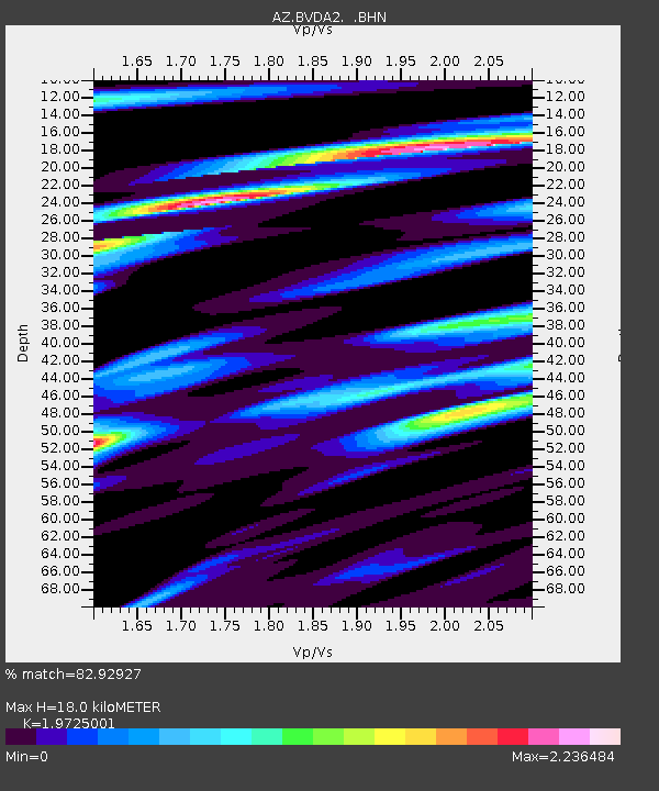
BVDA2 AZ.BVDA2 - Earthquake Result Viewer
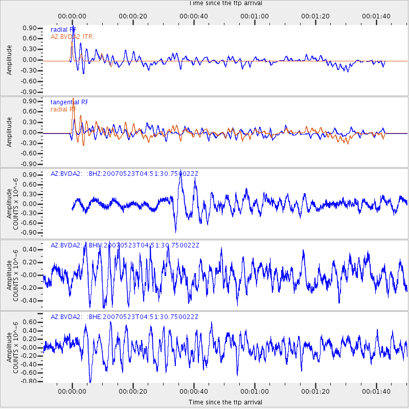
Earthquake location: Northern Mid-Atlantic Ridge
Earthquake latitude/longitude: 52.4/-31.8
Earthquake time(UTC): 2007/05/23 (143) 04:41:46 GMT
Earthquake Depth: 10 km
Earthquake Magnitude: 5.6 MS, 5.4 MB, 5.7 MW, 5.6 MW
Earthquake Catalog/Contributor: WHDF/NEIC
Network: AZ ANZA Regional Network
Station: BVDA2 AZ.BVDA2
Lat/Lon: 33.33 N/116.37 W
Elevation: 0.0 m
Distance: 61.3 deg
Az: 288.113 deg
Baz: 44.132 deg
Ray Param: 0.06098067
Estimated Moho Depth: 18.0 km
Estimated Crust Vp/Vs: 1.97
Assumed Crust Vp: 6.264 km/s
Estimated Crust Vs: 3.175 km/s
Estimated Crust Poisson's Ratio: 0.33
Radial Match: 82.92927 %
Radial Bump: 400
Transverse Match: 67.40637 %
Transverse Bump: 400
SOD ConfigId: 2564
Insert Time: 2010-02-26 18:39:02.548 +0000
GWidth: 2.5
Max Bumps: 400
Tol: 0.001

Signal To Noise

ChannelStoNSTALTA
AZ:BVDA2: :BHN:20070523T04:51:30.750022Z1.45140462.2795737E-71.5705984E-7
AZ:BVDA2: :BHE:20070523T04:51:30.750022Z1.62857652.3421813E-71.438177E-7
AZ:BVDA2: :BHZ:20070523T04:51:30.750022Z2.9242892.91759E-79.9770915E-8
Arrivals
Ps2.9 SECOND
PpPs8.2 SECOND
PsPs/PpSs11 SECOND