BVDA2 AZ.BVDA2 - Earthquake Result Viewer
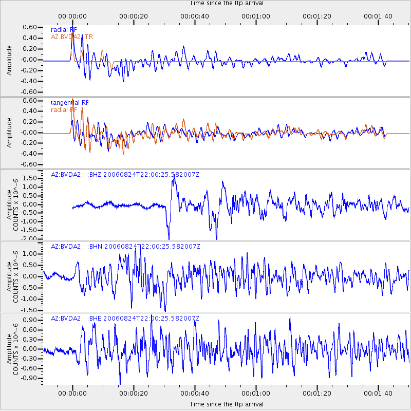
Earthquake location: Near East Coast Of Kamchatka
Earthquake latitude/longitude: 51.1/157.5
Earthquake time(UTC): 2006/08/24 (236) 21:50:36 GMT
Earthquake Depth: 43 km
Earthquake Magnitude: 5.9 MB, 6.2 MS, 6.5 MW, 6.5 MW
Earthquake Catalog/Contributor: WHDF/NEIC
Network: AZ ANZA Regional Network
Station: BVDA2 AZ.BVDA2
Lat/Lon: 33.33 N/116.37 W
Elevation: 0.0 m
Distance: 62.6 deg
Az: 70.224 deg
Baz: 314.933 deg
Ray Param: 0.060046222
Estimated Moho Depth: 26.5 km
Estimated Crust Vp/Vs: 1.74
Assumed Crust Vp: 6.264 km/s
Estimated Crust Vs: 3.605 km/s
Estimated Crust Poisson's Ratio: 0.25
Radial Match: 84.6629 %
Radial Bump: 400
Transverse Match: 80.62583 %
Transverse Bump: 400
SOD ConfigId: 2665
Insert Time: 2010-02-26 18:39:09.122 +0000
GWidth: 2.5
Max Bumps: 400
Tol: 0.001

Signal To Noise

ChannelStoNSTALTA
AZ:BVDA2: :BHN:20060824T22:00:25.582007Z3.97567374.2185903E-71.0611008E-7
AZ:BVDA2: :BHE:20060824T22:00:25.582007Z3.93822173.5558222E-79.0290044E-8
AZ:BVDA2: :BHZ:20060824T22:00:25.582007Z10.7203381.0144502E-69.462856E-8
Arrivals
Ps3.3 SECOND
PpPs11 SECOND
PsPs/PpSs14 SECOND