You are here: Home > Network List > UW - Pacific Northwest Regional Seismic Network Stations List
> Station UMAT Pilot Rock, OR, USA > Earthquake Result Viewer
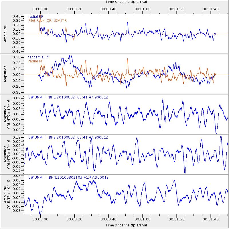
UMAT Pilot Rock, OR, USA - Earthquake Result Viewer
*The percent match for this event was below the threshold and hence no stack was calculated.
| Earthquake location: |
Central Mid-Atlantic Ridge |
| Earthquake latitude/longitude: |
7.1/-34.2 |
| Earthquake time(UTC): |
2010/08/02 (214) 03:30:02 GMT |
| Earthquake Depth: |
10 km |
| Earthquake Magnitude: |
5.8 MW, 4.9 MS, 4.9 MB, 5.6 MW |
| Earthquake Catalog/Contributor: |
WHDF/NEIC |
|
| Network: |
UW Pacific Northwest Regional Seismic Network |
| Station: |
UMAT Pilot Rock, OR, USA |
| Lat/Lon: |
45.29 N/118.96 W |
| Elevation: |
1318 m |
|
| Distance: |
81.3 deg |
| Az: |
314.676 deg |
| Baz: |
88.7 deg |
| Ray Param: |
$rayparam |
*The percent match for this event was below the threshold and hence was not used in the summary stack. |
|
| Radial Match: |
56.938118 % |
| Radial Bump: |
400 |
| Transverse Match: |
46.838943 % |
| Transverse Bump: |
400 |
| SOD ConfigId: |
319893 |
| Insert Time: |
2011-01-05 15:19:02.324 +0000 |
| GWidth: |
2.5 |
| Max Bumps: |
400 |
| Tol: |
0.001 |
|
Signal To Noise
| Channel | StoN | STA | LTA |
| UW:UMAT: :BHZ:20100802T03:41:47.90001Z | 0.7020786 | 3.6693418E-8 | 5.2263974E-8 |
| UW:UMAT: :BHN:20100802T03:41:47.90001Z | 1.9236064 | 7.0008E-8 | 3.6394137E-8 |
| UW:UMAT: :BHE:20100802T03:41:47.90001Z | 1.1275492 | 3.3062125E-8 | 2.9322113E-8 |
| Arrivals |
| Ps | |
| PpPs | |
| PsPs/PpSs | |


