You are here: Home > Network List > IW - Intermountain West Stations List
> Station MOOW Moose Ponds, Wyoming, USA > Earthquake Result Viewer
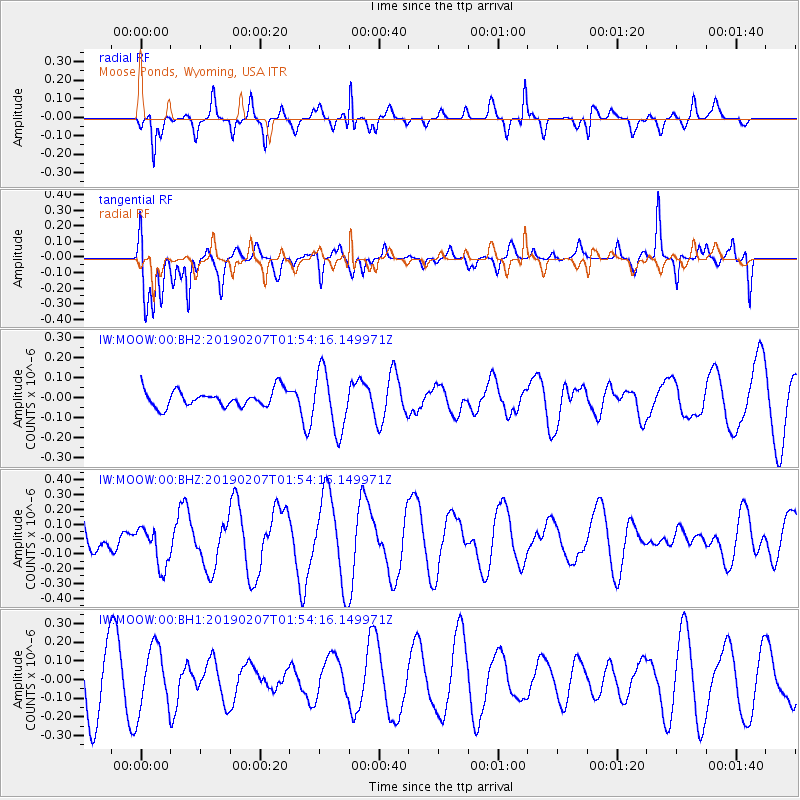
MOOW Moose Ponds, Wyoming, USA - Earthquake Result Viewer
*The percent match for this event was below the threshold and hence no stack was calculated.
| Earthquake location: |
Solomon Islands |
| Earthquake latitude/longitude: |
-8.5/161.0 |
| Earthquake time(UTC): |
2019/02/07 (038) 01:41:34 GMT |
| Earthquake Depth: |
66 km |
| Earthquake Magnitude: |
5.5 mb |
| Earthquake Catalog/Contributor: |
NEIC PDE/us |
|
| Network: |
IW Intermountain West |
| Station: |
MOOW Moose Ponds, Wyoming, USA |
| Lat/Lon: |
43.75 N/110.74 W |
| Elevation: |
2128 m |
|
| Distance: |
94.6 deg |
| Az: |
46.608 deg |
| Baz: |
262.725 deg |
| Ray Param: |
$rayparam |
*The percent match for this event was below the threshold and hence was not used in the summary stack. |
|
| Radial Match: |
77.35466 % |
| Radial Bump: |
361 |
| Transverse Match: |
67.109825 % |
| Transverse Bump: |
400 |
| SOD ConfigId: |
3287751 |
| Insert Time: |
2019-02-21 02:01:26.062 +0000 |
| GWidth: |
2.5 |
| Max Bumps: |
400 |
| Tol: |
0.001 |
|
Signal To Noise
| Channel | StoN | STA | LTA |
| IW:MOOW:00:BHZ:20190207T01:54:16.149971Z | 0.884494 | 1.3528361E-7 | 1.5295028E-7 |
| IW:MOOW:00:BH1:20190207T01:54:16.149971Z | 1.4413298 | 1.6871637E-7 | 1.1705605E-7 |
| IW:MOOW:00:BH2:20190207T01:54:16.149971Z | 3.5450408 | 1.4750475E-7 | 4.160876E-8 |
| Arrivals |
| Ps | |
| PpPs | |
| PsPs/PpSs | |


