You are here: Home > Network List > CI - Caltech Regional Seismic Network Stations List
> Station MPP McPhearson Peak > Earthquake Result Viewer
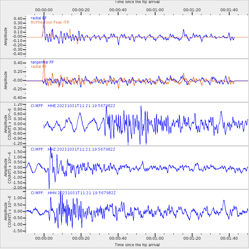
MPP McPhearson Peak - Earthquake Result Viewer
*The percent match for this event was below the threshold and hence no stack was calculated.
| Earthquake location: |
Fiji Islands Region |
| Earthquake latitude/longitude: |
-17.5/-179.0 |
| Earthquake time(UTC): |
2023/10/31 (304) 11:10:56 GMT |
| Earthquake Depth: |
548 km |
| Earthquake Magnitude: |
6.4 mww |
| Earthquake Catalog/Contributor: |
NEIC PDE/us |
|
| Network: |
CI Caltech Regional Seismic Network |
| Station: |
MPP McPhearson Peak |
| Lat/Lon: |
34.89 N/119.81 W |
| Elevation: |
1739 m |
|
| Distance: |
76.6 deg |
| Az: |
46.531 deg |
| Baz: |
237.385 deg |
| Ray Param: |
$rayparam |
*The percent match for this event was below the threshold and hence was not used in the summary stack. |
|
| Radial Match: |
60.381405 % |
| Radial Bump: |
400 |
| Transverse Match: |
53.718475 % |
| Transverse Bump: |
400 |
| SOD ConfigId: |
31937991 |
| Insert Time: |
2023-11-14 11:27:27.433 +0000 |
| GWidth: |
2.5 |
| Max Bumps: |
400 |
| Tol: |
0.001 |
|
Signal To Noise
| Channel | StoN | STA | LTA |
| CI:MPP: :HHZ:20231031T11:21:19.567982Z | 3.8524563 | 8.726642E-7 | 2.2652151E-7 |
| CI:MPP: :HHN:20231031T11:21:19.567982Z | 1.4659686 | 3.359966E-7 | 2.2919767E-7 |
| CI:MPP: :HHE:20231031T11:21:19.567982Z | 1.6119742 | 4.1872167E-7 | 2.5975706E-7 |
| Arrivals |
| Ps | |
| PpPs | |
| PsPs/PpSs | |


