You are here: Home > Network List > CN - Canadian National Seismograph Network Stations List
> Station INK INUVIK, NT > Earthquake Result Viewer
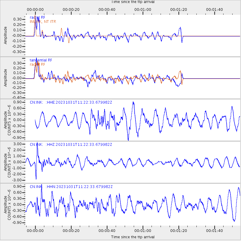
INK INUVIK, NT - Earthquake Result Viewer
*The percent match for this event was below the threshold and hence no stack was calculated.
| Earthquake location: |
Fiji Islands Region |
| Earthquake latitude/longitude: |
-17.5/-179.0 |
| Earthquake time(UTC): |
2023/10/31 (304) 11:10:56 GMT |
| Earthquake Depth: |
548 km |
| Earthquake Magnitude: |
6.4 mww |
| Earthquake Catalog/Contributor: |
NEIC PDE/us |
|
| Network: |
CN Canadian National Seismograph Network |
| Station: |
INK INUVIK, NT |
| Lat/Lon: |
68.31 N/133.53 W |
| Elevation: |
44 m |
|
| Distance: |
91.7 deg |
| Az: |
15.381 deg |
| Baz: |
222.894 deg |
| Ray Param: |
$rayparam |
*The percent match for this event was below the threshold and hence was not used in the summary stack. |
|
| Radial Match: |
75.458534 % |
| Radial Bump: |
330 |
| Transverse Match: |
74.5356 % |
| Transverse Bump: |
400 |
| SOD ConfigId: |
31937991 |
| Insert Time: |
2023-11-14 11:28:53.531 +0000 |
| GWidth: |
2.5 |
| Max Bumps: |
400 |
| Tol: |
0.001 |
|
Signal To Noise
| Channel | StoN | STA | LTA |
| CN:INK: :HHZ:20231031T11:22:33.679982Z | 3.4554765 | 1.2251486E-6 | 3.5455272E-7 |
| CN:INK: :HHN:20231031T11:22:33.679982Z | 1.8482645 | 3.5159894E-7 | 1.9023196E-7 |
| CN:INK: :HHE:20231031T11:22:33.679982Z | 1.4285445 | 3.2513685E-7 | 2.2760008E-7 |
| Arrivals |
| Ps | |
| PpPs | |
| PsPs/PpSs | |


