You are here: Home > Network List > CI - Caltech Regional Seismic Network Stations List
> Station RCT Rector, Visalia, CA, USA > Earthquake Result Viewer
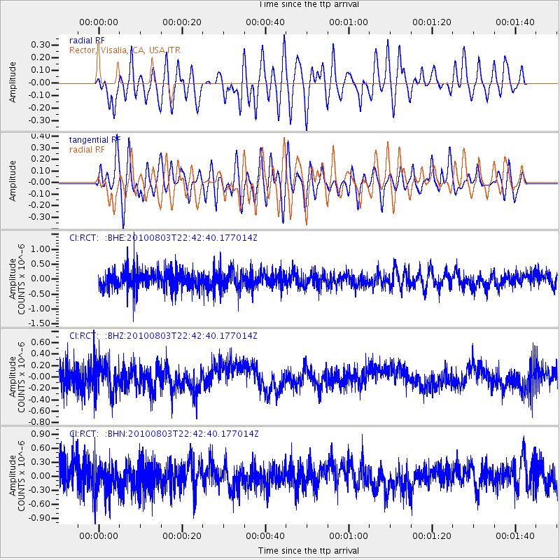
RCT Rector, Visalia, CA, USA - Earthquake Result Viewer
*The percent match for this event was below the threshold and hence no stack was calculated.
| Earthquake location: |
Southeast Of Loyalty Islands |
| Earthquake latitude/longitude: |
-22.6/171.5 |
| Earthquake time(UTC): |
2010/08/03 (215) 22:30:23 GMT |
| Earthquake Depth: |
16 km |
| Earthquake Magnitude: |
5.5 MB, 5.1 MS, 5.6 MW, 5.4 MW |
| Earthquake Catalog/Contributor: |
WHDF/NEIC |
|
| Network: |
CI Caltech Regional Seismic Network |
| Station: |
RCT Rector, Visalia, CA, USA |
| Lat/Lon: |
36.31 N/119.24 W |
| Elevation: |
107 m |
|
| Distance: |
87.7 deg |
| Az: |
49.111 deg |
| Baz: |
239.896 deg |
| Ray Param: |
$rayparam |
*The percent match for this event was below the threshold and hence was not used in the summary stack. |
|
| Radial Match: |
58.15888 % |
| Radial Bump: |
400 |
| Transverse Match: |
52.617176 % |
| Transverse Bump: |
400 |
| SOD ConfigId: |
319893 |
| Insert Time: |
2011-01-05 15:29:29.917 +0000 |
| GWidth: |
2.5 |
| Max Bumps: |
400 |
| Tol: |
0.001 |
|
Signal To Noise
| Channel | StoN | STA | LTA |
| CI:RCT: :BHZ:20100803T22:42:40.177014Z | 0.94655997 | 2.7993775E-7 | 2.957422E-7 |
| CI:RCT: :BHN:20100803T22:42:40.177014Z | 1.0626982 | 3.1907445E-7 | 3.0024935E-7 |
| CI:RCT: :BHE:20100803T22:42:40.177014Z | 1.0894945 | 3.3586417E-7 | 3.0827525E-7 |
| Arrivals |
| Ps | |
| PpPs | |
| PsPs/PpSs | |


