You are here: Home > Network List > IW - Intermountain West Stations List
> Station MOOW Moose Ponds, Wyoming, USA > Earthquake Result Viewer
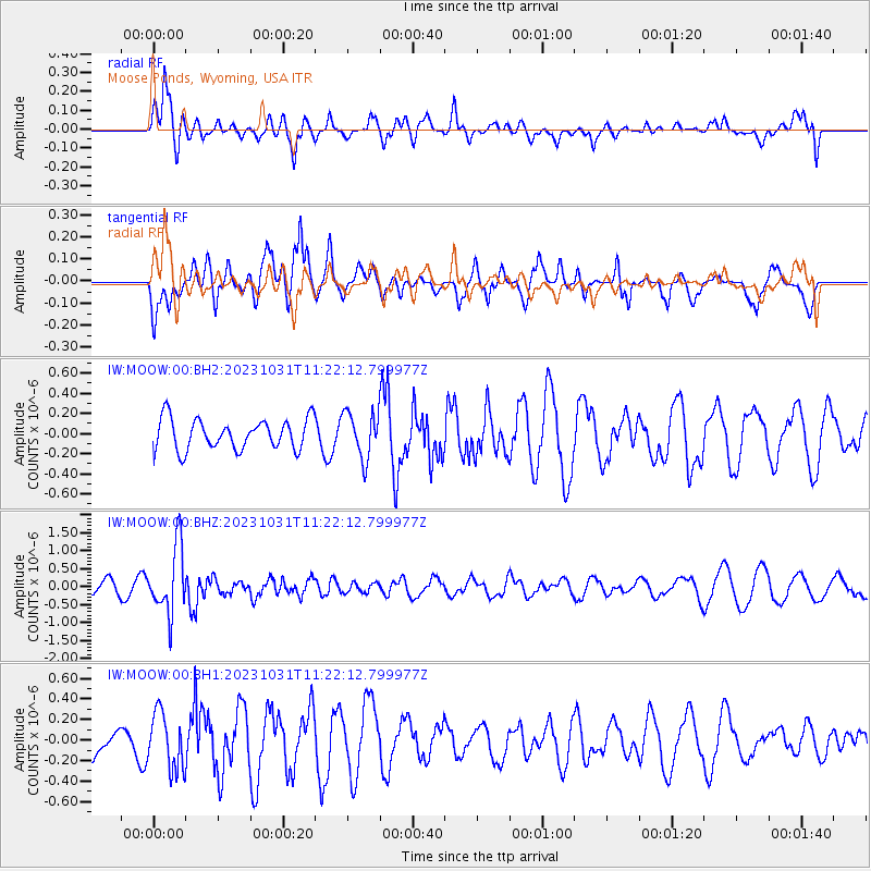
MOOW Moose Ponds, Wyoming, USA - Earthquake Result Viewer
*The percent match for this event was below the threshold and hence no stack was calculated.
| Earthquake location: |
Fiji Islands Region |
| Earthquake latitude/longitude: |
-17.5/-179.0 |
| Earthquake time(UTC): |
2023/10/31 (304) 11:10:56 GMT |
| Earthquake Depth: |
548 km |
| Earthquake Magnitude: |
6.4 mww |
| Earthquake Catalog/Contributor: |
NEIC PDE/us |
|
| Network: |
IW Intermountain West |
| Station: |
MOOW Moose Ponds, Wyoming, USA |
| Lat/Lon: |
43.75 N/110.74 W |
| Elevation: |
2128 m |
|
| Distance: |
87.2 deg |
| Az: |
42.378 deg |
| Baz: |
242.545 deg |
| Ray Param: |
$rayparam |
*The percent match for this event was below the threshold and hence was not used in the summary stack. |
|
| Radial Match: |
61.542614 % |
| Radial Bump: |
400 |
| Transverse Match: |
58.06261 % |
| Transverse Bump: |
400 |
| SOD ConfigId: |
31937991 |
| Insert Time: |
2023-11-14 11:32:05.678 +0000 |
| GWidth: |
2.5 |
| Max Bumps: |
400 |
| Tol: |
0.001 |
|
Signal To Noise
| Channel | StoN | STA | LTA |
| IW:MOOW:00:BHZ:20231031T11:22:12.799977Z | 5.6216846 | 9.360329E-7 | 1.66504E-7 |
| IW:MOOW:00:BH1:20231031T11:22:12.799977Z | 1.3163768 | 2.7228992E-7 | 2.0684801E-7 |
| IW:MOOW:00:BH2:20231031T11:22:12.799977Z | 1.5221545 | 2.2984966E-7 | 1.5100285E-7 |
| Arrivals |
| Ps | |
| PpPs | |
| PsPs/PpSs | |


