You are here: Home > Network List > IW - Intermountain West Stations List
> Station PLID Pearl Lake, Idaho, USA > Earthquake Result Viewer
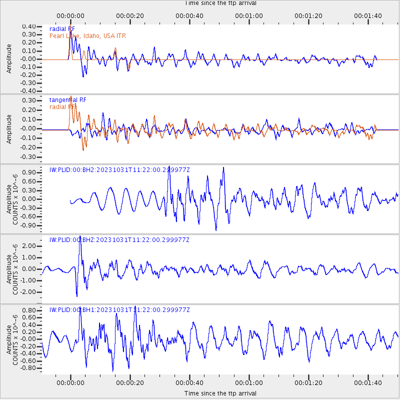
PLID Pearl Lake, Idaho, USA - Earthquake Result Viewer
*The percent match for this event was below the threshold and hence no stack was calculated.
| Earthquake location: |
Fiji Islands Region |
| Earthquake latitude/longitude: |
-17.5/-179.0 |
| Earthquake time(UTC): |
2023/10/31 (304) 11:10:56 GMT |
| Earthquake Depth: |
548 km |
| Earthquake Magnitude: |
6.4 mww |
| Earthquake Catalog/Contributor: |
NEIC PDE/us |
|
| Network: |
IW Intermountain West |
| Station: |
PLID Pearl Lake, Idaho, USA |
| Lat/Lon: |
45.09 N/116.00 W |
| Elevation: |
2164 m |
|
| Distance: |
84.5 deg |
| Az: |
39.356 deg |
| Baz: |
238.659 deg |
| Ray Param: |
$rayparam |
*The percent match for this event was below the threshold and hence was not used in the summary stack. |
|
| Radial Match: |
62.97429 % |
| Radial Bump: |
399 |
| Transverse Match: |
57.112713 % |
| Transverse Bump: |
400 |
| SOD ConfigId: |
31937991 |
| Insert Time: |
2023-11-14 11:32:05.955 +0000 |
| GWidth: |
2.5 |
| Max Bumps: |
400 |
| Tol: |
0.001 |
|
Signal To Noise
| Channel | StoN | STA | LTA |
| IW:PLID:00:BHZ:20231031T11:22:00.299977Z | 5.361115 | 1.1705905E-6 | 2.1834832E-7 |
| IW:PLID:00:BH1:20231031T11:22:00.299977Z | 0.9933684 | 3.2857702E-7 | 3.3077055E-7 |
| IW:PLID:00:BH2:20231031T11:22:00.299977Z | 1.879312 | 4.3806008E-7 | 2.3309597E-7 |
| Arrivals |
| Ps | |
| PpPs | |
| PsPs/PpSs | |


