You are here: Home > Network List > IU - Global Seismograph Network (GSN - IRIS/USGS) Stations List
> Station SLBS Sierra la Laguna Baja California Sur, Mexico > Earthquake Result Viewer
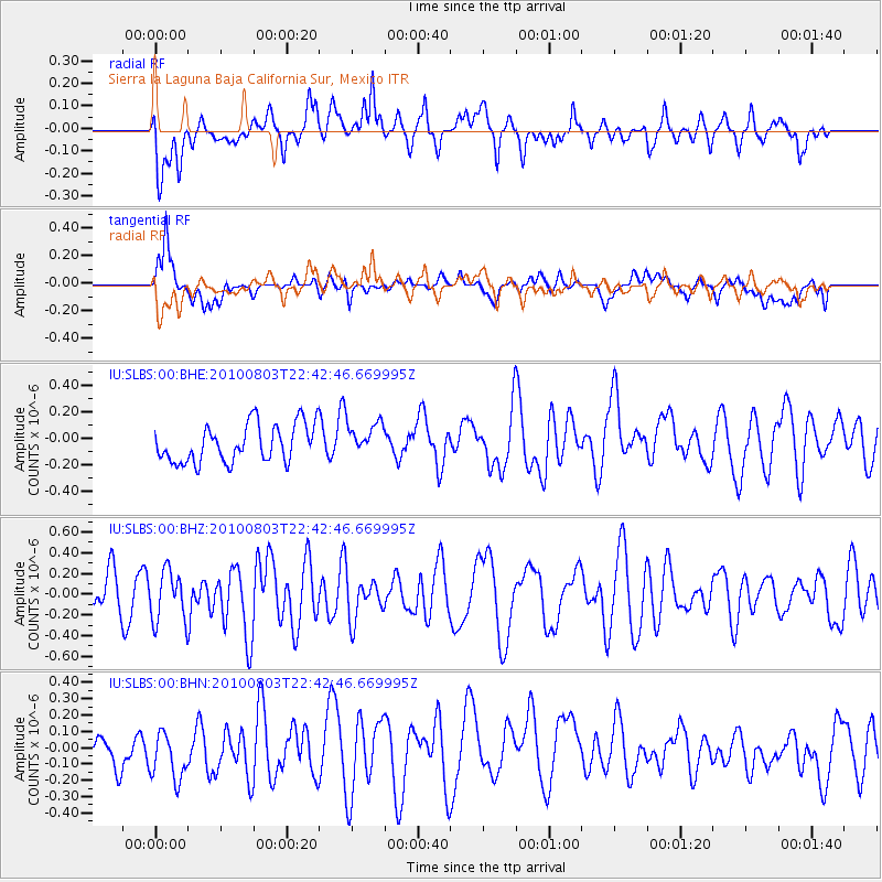
SLBS Sierra la Laguna Baja California Sur, Mexico - Earthquake Result Viewer
*The percent match for this event was below the threshold and hence no stack was calculated.
| Earthquake location: |
Southeast Of Loyalty Islands |
| Earthquake latitude/longitude: |
-22.6/171.5 |
| Earthquake time(UTC): |
2010/08/03 (215) 22:30:23 GMT |
| Earthquake Depth: |
16 km |
| Earthquake Magnitude: |
5.5 MB, 5.1 MS, 5.6 MW, 5.4 MW |
| Earthquake Catalog/Contributor: |
WHDF/NEIC |
|
| Network: |
IU Global Seismograph Network (GSN - IRIS/USGS) |
| Station: |
SLBS Sierra la Laguna Baja California Sur, Mexico |
| Lat/Lon: |
23.69 N/109.94 W |
| Elevation: |
825 m |
|
| Distance: |
89.1 deg |
| Az: |
63.978 deg |
| Baz: |
244.972 deg |
| Ray Param: |
$rayparam |
*The percent match for this event was below the threshold and hence was not used in the summary stack. |
|
| Radial Match: |
70.37794 % |
| Radial Bump: |
400 |
| Transverse Match: |
50.069935 % |
| Transverse Bump: |
400 |
| SOD ConfigId: |
319893 |
| Insert Time: |
2011-01-05 15:30:47.303 +0000 |
| GWidth: |
2.5 |
| Max Bumps: |
400 |
| Tol: |
0.001 |
|
Signal To Noise
| Channel | StoN | STA | LTA |
| IU:SLBS:00:BHZ:20100803T22:42:46.669995Z | 1.3580096 | 2.4786976E-7 | 1.825243E-7 |
| IU:SLBS:00:BHN:20100803T22:42:46.669995Z | 1.1002251 | 1.8828469E-7 | 1.7113287E-7 |
| IU:SLBS:00:BHE:20100803T22:42:46.669995Z | 0.87616885 | 1.2492482E-7 | 1.4258077E-7 |
| Arrivals |
| Ps | |
| PpPs | |
| PsPs/PpSs | |


